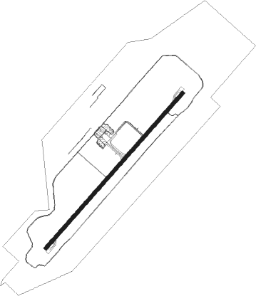
Mattala Rajapaksa Intl
Airport details
| Country | Sri Lanka |
| State | Southern Province |
| Region | VC |
| Airspace | Colombo Ctr |
| Municipality | Hambantota District |
| Elevation | 158ft (48m) |
| Timezone | GMT +5.5 |
| Coordinates | 6.28447, 81.12413 |
| Magnetic var | |
| Type | land |
| Available since | X-Plane v10.40 |
| ICAO code | VCRI |
| IATA code | HRI |
| FAA code | n/a |
Communication
| Mattala Rajapaksa Intl AWOS | 121.700 |
| Mattala Rajapaksa Intl Tower | 119.850 |
| Mattala Rajapaksa Intl Departure | 119.850 |
Approach frequencies
| ILS-cat-I | RW23 | 109.5 | 18.00mi |
| 3° GS | RW23 | 109.5 | 18.00mi |
Nearby Points of Interest:
Bundala National Park
-Matara fort
Nearby beacons
| code | identifier | dist | bearing | frequency |
|---|---|---|---|---|
| MTL | MATTALA VOR/DME | 1.6 | 46° | 116.70 |
Departure and arrival routes
| Transition altitude | 11000ft |
| Transition level | 13000ft |
| SID end points | distance | outbound heading | |
|---|---|---|---|
| RW05 | |||
| HA1B | 51mi | 42° | |
| HC1B | 51mi | 100° | |
| HG1B | 49mi | 260° | |
| HK1B | 92mi | 305° | |
| HH1B | 232mi | 344° | |
| RW23 | |||
| HA1A | 51mi | 42° | |
| HC1A | 51mi | 100° | |
| HG1A | 49mi | 260° | |
| HK1A | 92mi | 305° | |
| HH1A | 232mi | 344° | |
| STAR starting points | distance | inbound heading | |
|---|---|---|---|
| RW05 | |||
| HG1C | 48.5 | 80° | |
| HK1C | 91.5 | 125° | |
| HH1C | 231.5 | 164° | |
| HA1C | 51.3 | 222° | |
| HC1C | 50.7 | 280° | |
| RW23 | |||
| HG1D | 48.5 | 80° | |
| HK1D | 91.5 | 125° | |
| HH1D | 231.5 | 164° | |
| HA1D | 51.3 | 222° | |
| HC1D | 50.7 | 280° | |
Instrument approach procedures
| runway | airway (heading) | route (dist, bearing) |
|---|---|---|
| RW05 | BIDOS (75°) | BIDOS 2500ft RI051 (6mi, 136°) 2500ft |
| RW05 | ESGOB (17°) | ESGOB 2500ft RI051 (6mi, 316°) 2500ft |
| RW05 | SUGNU (46°) | SUGNU 2500ft RI051 (6mi, 46°) 2500ft |
| RNAV | RI051 2500ft RI052 (5mi, 46°) 1800ft VCRI (6mi, 46°) 186ft RI053 (6mi, 46°) VCRI (6mi, 226°) 3000ft ESGOB (13mi, 197°) 3500ft ESGOB (turn) 3500ft | |
| RW23 | BOVNA (255°) | BOVNA 3500ft RI230 (6mi, 316°) 2500ft |
| RW23 | DOVAD (197°) | DOVAD 3500ft RI230 (6mi, 136°) 2500ft |
| RNAV | RI230 2500ft RI053 (5mi, 226°) 1800ft VCRI (6mi, 226°) 209ft RI052 (6mi, 226°) 1400ft ESGOB (8mi, 176°) 3500ft ESGOB (turn) 3500ft |
Disclaimer
The information on this website is not for real aviation. Use this data with the X-Plane flight simulator only! Data taken with kind consent from X-Plane 12 source code and data files. Content is subject to change without notice.