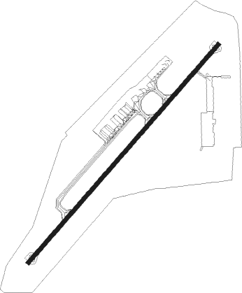
Phnom Penh - Phnom Penh Intl
Airport details
| Country | Cambodia |
| State | Phnom Penh |
| Region | VD |
| Airspace | Phnom Penh Ctr |
| Municipality | Khan Pou Senchey |
| Elevation | 40ft (12m) |
| Timezone | GMT +7 |
| Coordinates | 11.54653, 104.84412 |
| Magnetic var | |
| Type | land |
| Available since | X-Plane v10.40 |
| ICAO code | VDPP |
| IATA code | PNH |
| FAA code | n/a |
Communication
| Phnom Penh Intl ATIS | 127.250 |
| Phnom Penh Intl Ground | 129.000 |
| Phnom Penh Intl Tower | 118.000 |
| Phnom Penh Intl Approach | 123.800 |
Approach frequencies
| IGS | RW23 | 109.7 | 18.00mi |
| 3° GS | RW23 | 109.7 | 18.00mi |
Nearby beacons
| code | identifier | dist | bearing | frequency |
|---|---|---|---|---|
| PNH | PHNOM PENH VOR/DME | 0.1 | 184° | 114.30 |
Departure and arrival routes
| Transition altitude | 10000ft |
| SID end points | distance | outbound heading | |
|---|---|---|---|
| RW05 | |||
| SEYHA1 | 139mi | 15° | |
| NANXY1 | 201mi | 51° | |
| BAVET1 | 70mi | 111° | |
| CONDA1 | 61mi | 190° | |
| BENTI1 | 69mi | 210° | |
| AKATA1 | 91mi | 231° | |
| ATMI1B | 155mi | 298° | |
| MADAM1 | 127mi | 331° | |
| RW23 | |||
| SEYHA1 | 139mi | 15° | |
| NANXY1 | 201mi | 51° | |
| BAVET1 | 70mi | 111° | |
| CONDA1 | 61mi | 190° | |
| BENTI1 | 69mi | 210° | |
| AKATA1 | 91mi | 231° | |
| OLTA1A | 155mi | 298° | |
| MADAM1 | 127mi | 331° | |
| STAR starting points | distance | inbound heading | |
|---|---|---|---|
| RW05 | |||
| COND1B | 61.3 | 10° | |
| BENT1B | 68.8 | 30° | |
| AKAT1B | 91.2 | 51° | |
| KELE1B | 161.8 | 121° | |
| DAMA1B | 85.9 | 169° | |
| SEYH1B | 139.4 | 195° | |
| NANX1B | 201.0 | 231° | |
| DALI1B | 70.3 | 291° | |
| RW23 | |||
| NARE1A | 61.3 | 10° | |
| OUDO1A | 68.8 | 30° | |
| BASA1A | 91.2 | 51° | |
| SOBE1A | 161.8 | 121° | |
| DAMA1A | 85.9 | 169° | |
| EATD1A | 139.4 | 195° | |
| DETM1A | 201.0 | 231° | |
| BAVE1A | 70.3 | 291° | |
Instrument approach procedures
| runway | airway (heading) | route (dist, bearing) |
|---|---|---|
| RW05 | BATEE (29°) | BATEE 4000ft BOSET (5mi, 315°) 4000ft |
| RW05 | PISEY (64°) | PISEY 4000ft BOSET (5mi, 135°) 4000ft |
| RNAV | BOSET 4000ft FF05 (10mi, 46°) 1700ft VDPP (6mi, 46°) 90ft (6278mi, 264°) 1000ft BOSET (6267mi, 84°) 4000ft BOSET (turn) | |
| RW23 | KOSTO (201°) | KOSTO 2000ft KOSDA (5mi, 135°) 2000ft |
| RW23 | TAMEN (251°) | TAMEN 2000ft KOSDA (5mi, 315°) 2000ft |
| RNAV | KOSDA 2000ft FR23 (5mi, 226°) 1600ft VDPP (5mi, 226°) 90ft (6278mi, 264°) 1000ft KOSDA (6285mi, 84°) 2000ft KOSDA (turn) |
Holding patterns
| STAR name | hold at | type | turn | heading* | altitude | leg | speed limit |
|---|---|---|---|---|---|---|---|
| BASA1A | PP111 | VHF | right | 130 (310)° | > 6000ft | 1.0min timed | ICAO rules |
| NARE1A | PP111 | VHF | right | 130 (310)° | > 6000ft | 1.0min timed | ICAO rules |
| OUDO1A | PP111 | VHF | right | 130 (310)° | > 6000ft | 1.0min timed | ICAO rules |
| *) magnetic outbound (inbound) holding course | |||||||
Disclaimer
The information on this website is not for real aviation. Use this data with the X-Plane flight simulator only! Data taken with kind consent from X-Plane 12 source code and data files. Content is subject to change without notice.