Cooch Behar
Airport details
| Country | India |
| State | West Bengal |
| Region | VE |
| Airspace | Guwahati Ctr |
| Municipality | Cooch Behar |
| Elevation | 138ft (42m) |
| Timezone | GMT +5.5 |
| Coordinates | 26.32952, 89.46834 |
| Magnetic var | |
| Type | land |
| Available since | X-Plane v10.40 |
| ICAO code | VECO |
| IATA code | COH |
| FAA code | n/a |
Communication
| Cooch Behar Tower | 122.300 |
Nearby Points of Interest:
Buxa Fort
-Panbari Mosque
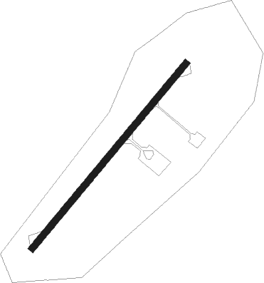
Runway info
| Runway 04 / 22 | ||
| length | 1069m (3507ft) | |
| bearing | 47° / 227° | |
| width | 30m (100ft) | |
| surface | asphalt | |
| blast zone | 59m (194ft) / 83m (272ft) | |
Nearby beacons
| code | identifier | dist | bearing | frequency |
|---|---|---|---|---|
| SD | SAIDPUR NDB | 45.3 | 225° | 268 |
| SDP | SAIDPUR VOR/DME | 45.4 | 225° | 115.80 |
| PRO | PARO VOR/DME | 58.3 | 2° | 108.40 |
| TA | TURA NDB | 61.8 | 127° | 378 |
| PKG | PAKYONG VOR/DME | 71.7 | 316° | 117.80 |
Disclaimer
The information on this website is not for real aviation. Use this data with the X-Plane flight simulator only! Data taken with kind consent from X-Plane 12 source code and data files. Content is subject to change without notice.