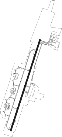
Guwahati
Airport details
| Country | India |
| State | Assam |
| Region | VE |
| Airspace | Guwahati Ctr |
| Municipality | Azara |
| Elevation | 162ft (49m) |
| Timezone | GMT +5.5 |
| Coordinates | 26.09898, 91.57963 |
| Magnetic var | |
| Type | land |
| Available since | X-Plane v10.40 |
| ICAO code | VEGT |
| IATA code | GAU |
| FAA code | n/a |
Communication
| Guwahati ATIS | 126.600 |
| Guwahati Ground Control | 121.900 |
| Guwahati Tower | 118.750 |
| Guwahati Approach | 123.900 |
Approach frequencies
| ILS-cat-I | RW02 | 110.3 | 18.00mi |
| 3.2° GS | RW02 | 110.3 | 18.00mi |
Nearby beacons
| code | identifier | dist | bearing | frequency |
|---|---|---|---|---|
| GT | GUWAHATI NDB | 1.3 | 67° | 360 |
| GGT | GUWAHATI VOR/DME | 2.3 | 27° | 117.60 |
| GH | LOKPRIYA GOPINATH BORDOLOI INT NDB | 3.9 | 203° | 401 |
| BPN | BARAPANI VOR/DME | 31.8 | 134° | 116 |
Departure and arrival routes
| Transition altitude | 9000ft |
| SID end points | distance | outbound heading | |
|---|---|---|---|
| RW02 | |||
| DUMOX | 79mi | 130° | |
| TOPAM | 146mi | 280° | |
| RW20 | |||
| VATCO | 79mi | 130° | |
| STAR starting points | distance | inbound heading | |
|---|---|---|---|
| RW02 | |||
| POLOT | 19.4 | 12° | |
| NAPOK | 18.3 | 63° | |
| BUBTA | 16.9 | 309° | |
| RW20 | |||
| GOBIT | 15.0 | 140° | |
| RUPAK | 29.2 | 241° | |
| TOPRA | 19.7 | 283° | |
Holding patterns
| STAR name | hold at | type | turn | heading* | altitude | leg | speed limit |
|---|---|---|---|---|---|---|---|
| BUBTA | BUBTA | VHF | right | 85 (265)° | 6000ft - 7000ft | 1.0min timed | 230 |
| GOBIT | GOBIT | VHF | left | 255 (75)° | 6000ft - 8000ft | 1.0min timed | 230 |
| NAPOK | NAPOK | VHF | left | 274 (94)° | 6000ft - 8000ft | 1.0min timed | 230 |
| PARUT | GH461 | VHF | right | 113 (293)° | 3500ft - 7000ft | 1.0min timed | 230 |
| POLOT | POLOT | VHF | right | 183 (3)° | > 9000ft | 1.0min timed | 230 |
| TOPRA | GH461 | VHF | right | 113 (293)° | 3500ft - 7000ft | 1.0min timed | 230 |
| *) magnetic outbound (inbound) holding course | |||||||
Disclaimer
The information on this website is not for real aviation. Use this data with the X-Plane flight simulator only! Data taken with kind consent from X-Plane 12 source code and data files. Content is subject to change without notice.