Uttarkāshi - Bharkot
Airport details
| Country | India |
| State | Uttarakhand |
| Region | |
| Airspace | Delhi Ctr |
| Municipality | Chinyali Saur |
| Elevation | 2980ft (908m) |
| Timezone | GMT +5.5 |
| Coordinates | 30.58437, 78.32310 |
| Magnetic var | |
| Type | land |
| Available since | X-Plane v10.40 |
| ICAO code | VI82 |
| IATA code | n/a |
| FAA code | n/a |
Communication
Nearby Points of Interest:
Khalsi inscription
-Temple and images in its vicinity
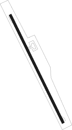
Runway info
| Runway 16 / 34 | ||
| length | 1086m (3563ft) | |
| bearing | 155° / 335° | |
| width | 23m (75ft) | |
| surface | asphalt | |
| blast zone | 84m (276ft) / 50m (164ft) | |
Nearby beacons
| code | identifier | dist | bearing | frequency |
|---|---|---|---|---|
| DDN | DEHRADUN VOR/DME | 25 | 202° | 112.60 |
| SP | SARSAWA NDB | 58 | 237° | 298 |
Disclaimer
The information on this website is not for real aviation. Use this data with the X-Plane flight simulator only! Data taken with kind consent from X-Plane 12 source code and data files. Content is subject to change without notice.