Dhilwan - Jallowal
Airport details
| Country | India |
| State | Punjab |
| Region | |
| Airspace | Delhi Ctr |
| Municipality | Baba Bakala Tahsil |
| Elevation | 741ft (226m) |
| Timezone | GMT +5.5 |
| Coordinates | 31.56518, 75.33918 |
| Magnetic var | |
| Type | land |
| Available since | X-Plane v10.40 |
| ICAO code | VI88 |
| IATA code | n/a |
| FAA code | n/a |
Communication
Nearby Points of Interest:
Harike Wetland
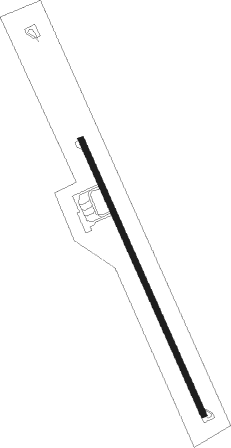
Runway info
| Runway 16 / 34 | ||
| length | 1698m (5571ft) | |
| bearing | 157° / 337° | |
| width | 32m (105ft) | |
| surface | asphalt | |
| blast zone | 255m (837ft) / 0m (0ft) | |
Nearby beacons
| code | identifier | dist | bearing | frequency |
|---|---|---|---|---|
| AR | AMRITSAR NDB | 28.1 | 283° | 351 |
| AAR | AMRITSAR VOR/DME | 29.9 | 286° | 115.50 |
| PK | PATHANKOT NDB | 43.2 | 24° | 393 |
| LA | LAHORE VOR/DME | 48.1 | 267° | 112.70 |
| LA | LAHORE NDB | 48.3 | 267° | 268 |
| LO | LAHORE NDB | 48.5 | 263° | 338 |
| LNA | LUDHIANA VOR/DME | 53.6 | 139° | 113.50 |
| KNG | KANGRA VOR/DME | 59.4 | 57° | 117.70 |
Disclaimer
The information on this website is not for real aviation. Use this data with the X-Plane flight simulator only! Data taken with kind consent from X-Plane 12 source code and data files. Content is subject to change without notice.