Kanpur
Airport details
| Country | India |
| State | Uttar Pradesh |
| Region | |
| Airspace | Kolkata Ctr |
| Municipality | Kanpur |
| Elevation | 411ft (125m) |
| Timezone | GMT +5.5 |
| Coordinates | 26.44219, 80.35841 |
| Magnetic var | |
| Type | land |
| Available since | X-Plane v10.40 |
| ICAO code | VIKA |
| IATA code | KNU |
| FAA code | n/a |
Communication
| Kanpur Tower | 122.300 |
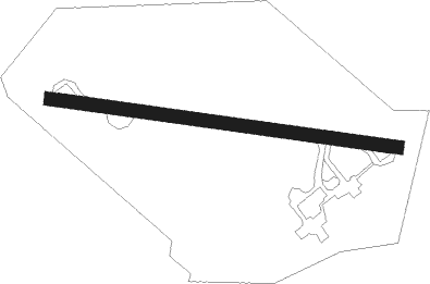
Runway info
| Runway 10 / 28 | ||
| length | 1121m (3678ft) | |
| bearing | 101° / 281° | |
| width | 41m (135ft) | |
| surface | concrete | |
| displ threshold | 457m (1499ft) / 210m (689ft) | |
Nearby beacons
| code | identifier | dist | bearing | frequency |
|---|---|---|---|---|
| KA | KANPUR NDB | 2.4 | 119° | 292 |
| KCH | KANPUR VOR/DME | 4.2 | 121° | 115.30 |
| LKN | LUCKNOW VOR/DME | 34.4 | 59° | 117.40 |
Disclaimer
The information on this website is not for real aviation. Use this data with the X-Plane flight simulator only! Data taken with kind consent from X-Plane 12 source code and data files. Content is subject to change without notice.