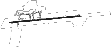
Lucknow
Airport details
| Country | India |
| State | Uttar Pradesh |
| Region | VI |
| Airspace | Delhi Ctr |
| Municipality | Lucknow |
| Elevation | 410ft (125m) |
| Timezone | GMT +5.5 |
| Coordinates | 26.76185, 80.88342 |
| Magnetic var | |
| Type | land |
| Available since | X-Plane v10.40 |
| ICAO code | VILK |
| IATA code | LKO |
| FAA code | n/a |
Communication
| Lucknow ATIS | 126.800 |
| Lucknow Tower | 119.700 |
| Lucknow Tower | 118.600 |
| Lucknow Approach | 119.600 |
| Lucknow Departure (Tower) | 118.600 |
Approach frequencies
| ILS-cat-III | RW27 | 109.9 | 18.00mi |
| 3° GS | RW27 | 109.9 | 18.00mi |
Nearby Points of Interest:
Dilkusha Kothi
-Chhota Imambara
-Rumi Darwaza
Nearby beacons
| code | identifier | dist | bearing | frequency |
|---|---|---|---|---|
| LKN | LUCKNOW VOR/DME | 0.6 | 106° | 117.40 |
| KCH | KANPUR VOR/DME | 32.7 | 232° | 115.30 |
| KA | KANPUR NDB | 33.1 | 235° | 292 |
Instrument approach procedures
| runway | airway (heading) | route (dist, bearing) |
|---|---|---|
| RW09-Y | LK403 (113°) | LK403 5000ft LK402 (7mi, 179°) 3500ft |
| RW09-Y | LK404 (89°) | LK404 5000ft LK402 (7mi, 89°) 3500ft |
| RW09-Y | LK405 (65°) | LK405 5000ft LK402 (7mi, 359°) 3500ft |
| RNAV | LK402 3500ft LK401 (7mi, 89°) 2500ft VILK (7mi, 89°) 455ft LK406 (7mi, 90°) LK407 (7mi, 184°) LK405 (20mi, 269°) LK402 (7mi, 359°) 3500ft LK402 (turn) 3500ft | |
| RW27-Y | SADAT (247°) | SADAT ATETO (5mi, 179°) 2000ft |
| RW27-Y | UGABU (270°) | UGABU ATETO (5mi, 269°) 2000ft |
| RW27-Y | XINTO (292°) | XINTO ATETO (5mi, 359°) 2000ft |
| RNAV | ATETO 2000ft LK912 (5mi, 269°) 2000ft VILK (6mi, 270°) 450ft GULGI (5mi, 268°) 2500ft XINTO (17mi, 105°) 2500ft XINTO (turn) 2500ft |
Disclaimer
The information on this website is not for real aviation. Use this data with the X-Plane flight simulator only! Data taken with kind consent from X-Plane 12 source code and data files. Content is subject to change without notice.