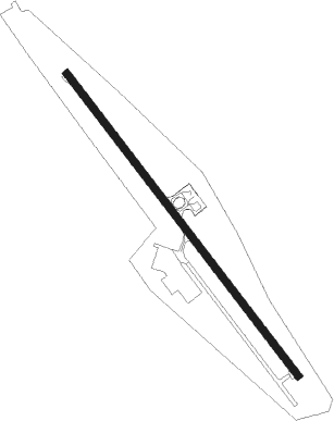
Pakse
Airport details
| Country | Laos |
| State | Champasak Province |
| Region | VL |
| Airspace | Vientiane Ctr |
| Municipality | Pakse |
| Elevation | 351ft (107m) |
| Timezone | GMT +7 |
| Coordinates | 15.13528, 105.77917 |
| Magnetic var | |
| Type | land |
| Available since | X-Plane v10.40 |
| ICAO code | VLPS |
| IATA code | PKZ |
| FAA code | n/a |
Communication
| Pakse Tower | 118.500 |
Approach frequencies
| ILS-cat-I | RW15 | 108.9 | 18.00mi |
| 3° GS | RW15 | 108.9 | 18.00mi |
Nearby Points of Interest:
Champasak cultural landscape
Nearby beacons
| code | identifier | dist | bearing | frequency |
|---|---|---|---|---|
| PAK | PAKSE VOR/DME | 4.3 | 326° | 115 |
| SAR | SARAVANE NDB | 50.2 | 48° | 200 |
| UBL | UBON (UBON RATCHATHANI) VOR/DME | 53.3 | 277° | 112.70 |
| UB | UBON (UBON RATCHATHANI) NDB | 53.4 | 277° | 373 |
Departure and arrival routes
| Transition altitude | 11000ft |
| Transition level | 13000ft |
| SID end points | distance | outbound heading | |
|---|---|---|---|
| RW15 | |||
| DOK1B | 62mi | 194° | |
| LAP1B | 53mi | 277° | |
| SAM1B | 29mi | 356° | |
| RW33 | |||
| SEKO2A | 106mi | 116° | |
| LEKO2A, DOK1A | 62mi | 194° | |
| LAP1A, UBL2A | 53mi | 277° | |
| SAM1A | 29mi | 356° | |
| LASA2A | 52mi | 358° | |
| STAR starting points | distance | inbound heading | |
|---|---|---|---|
| RW15 | |||
| DOK1C | 62.2 | 14° | |
| LAP1C | 53.3 | 97° | |
| SAM1C | 28.8 | 176° | |
Disclaimer
The information on this website is not for real aviation. Use this data with the X-Plane flight simulator only! Data taken with kind consent from X-Plane 12 source code and data files. Content is subject to change without notice.
