Bhojpur
Airport details
| Country | Nepal |
| State | Kosi |
| Region | VN |
| Airspace | Kathmandu Ctr |
| Municipality | Bhojpur |
| Elevation | 3969ft (1210m) |
| Timezone | GMT +5.75 |
| Coordinates | 27.14750, 87.05083 |
| Magnetic var | |
| Type | land |
| Available since | X-Plane v10.40 |
| ICAO code | VNBJ |
| IATA code | BHP |
| FAA code | n/a |
Communication
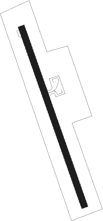
Runway info
| Runway 17 / 35 | ||
| length | 528m (1732ft) | |
| bearing | 163° / 343° | |
| width | 18m (59ft) | |
| surface | asphalt | |
Nearby beacons
| code | identifier | dist | bearing | frequency |
|---|---|---|---|---|
| BRT | BIRATNAGAR VOR/DME | 41.3 | 163° | 114.10 |
Disclaimer
The information on this website is not for real aviation. Use this data with the X-Plane flight simulator only! Data taken with kind consent from X-Plane 12 source code and data files. Content is subject to change without notice.