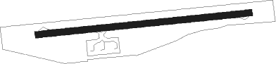
Airports for X-Plane offers a convenient way to explore airports and their related communication information for the X-Plane flight simulator. It only uses data from the X-Plane flight simulator itself, and is therefore more reliable than the data that comes from real aviation websites. You can search for airports by using the ICAO code, or browse for airports per country and state. The information displayed is categorized by airport details, runway information, airport communication, approach frequencies (ILS and Glidepath details), details of nearby beacons, SIDs, STARs and approach procedures.

jetliner military faa capital airport regional customs airfield seaplanes landing area helipad public transport commuter airfield traffic pattern asphalt metro flight attendant luggage airport check-in kennedy

Jumla

Airport details

CountryNepal
StateKarnali
RegionVN
AirspaceKathmandu Ctr
MunicipalityChandannath
Elevation7700ft (2347m)
TimezoneGMT +5.75
Coordinates29.27389, 82.18972
Magnetic var
Typeland
Available sinceX-Plane v10.40
ICAO codeVNJL
IATA codeJUM
FAA coden/a

Communication

Jumla Jumla AFIS122.500
Nearby Points of Interest:
Sinja Valley

Runway info

Runway 09 / 27
 length675m (2215ft)
 bearing89° / 269°
 width20m (66ft)
 surfaceasphalt

Airport layout


Disclaimer

The information on this website is not for real aviation. Use this data with the X-Plane flight simulator only! Data taken with kind consent from X-Plane 12 source code and data files. Content is subject to change without notice.