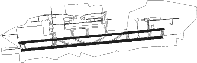
Hyderabad - Rajiv Gandhi International Airport
Airport details
| Country | India |
| State | Telangana |
| Region | VO |
| Airspace | Chennai Ctr |
| Municipality | Balapur mandal |
| Elevation | 2021ft (616m) |
| Timezone | GMT +5.5 |
| Coordinates | 17.24055, 78.42889 |
| Magnetic var | |
| Type | land |
| Available since | X-Plane v10.40 |
| ICAO code | VOHS |
| IATA code | HYD |
| FAA code | n/a |
Communication
| Rajiv Gandhi International Airport Shamshabad ATIS | 126.475 |
| Rajiv Gandhi International Airport Shamshabad CLR | 121.625 |
| Rajiv Gandhi International Airport Shamshabad Ground Control | 121.850 |
| Rajiv Gandhi International Airport Shamshabad Tower | 118.450 |
| Rajiv Gandhi International Airport Hyderabad Approach | 125.550 |
| Rajiv Gandhi International Airport Hyderabad Approach | 120.250 |
| Rajiv Gandhi International Airport Hyderabad Control | 120.950 |
| Rajiv Gandhi International Airport Hyderabad Control | 128.350 |
Approach frequencies
| ILS-cat-I | RW09R | 108.5 | 18.00mi |
| ILS-cat-I | RW27L | 110.9 | 18.00mi |
| 3° GS | RW09R | 108.5 | 18.00mi |
| 3° GS | RW27L | 110.9 | 18.00mi |
Nearby Points of Interest:
Jama Masjid Gulbarga
-Gunfoundry
-Toli Masjid
Runway info
Runway 09L / 27R  | ||
| length | 4392m (14409ft) | |
| bearing | 89° / 269° | |
| width | 46m (150ft) | |
| surface | asphalt | |
| displ threshold | 329m (1079ft) / 359m (1178ft) | |
| Runway 09R / 27L | ||
| length | 4259m (13973ft) | |
| bearing | 89° / 269° | |
| width | 61m (200ft) | |
| surface | asphalt | |
| blast zone | 58m (190ft) / 59m (194ft) | |
Nearby beacons
| code | identifier | dist | bearing | frequency |
|---|---|---|---|---|
| HIA | HYDERABAD VOR/DME | 1.5 | 241° | 113.80 |
| HHY | HYDERABAD VOR/DME | 12.9 | 8° | 114.70 |
| BR | BIDAR NDB | 67 | 306° | 240 |
| BDR | BIDAR VOR/DME | 67.3 | 305° | 113.20 |
Departure and arrival routes
| Transition altitude | 7000ft |
| SID end points | distance | outbound heading | |
|---|---|---|---|
| RW09R | |||
| VIRKO7 | 164mi | 78° | |
| BBZ7 | 145mi | 106° | |
| BOPRI7 | 133mi | 138° | |
| LURGI7 | 62mi | 175° | |
| VABDI7 | 129mi | 175° | |
| BOGAT7 | 149mi | 250° | |
| TAMIV7 | 142mi | 280° | |
| DEBIR7 | 119mi | 331° | |
| RW27L | |||
| VIRKO5 | 164mi | 78° | |
| BBZ5 | 145mi | 106° | |
| BOPRI5 | 133mi | 138° | |
| LURGI5 | 62mi | 175° | |
| VABDI5 | 129mi | 175° | |
| BOGAT5 | 149mi | 250° | |
| TAMIV5 | 142mi | 280° | |
| NADEL5 | 119mi | 331° | |
| STAR starting points | distance | inbound heading | |
|---|---|---|---|
| RW09 (ALL) | |||
| SARKA8 | 41.1 | 11° | |
| NAMSA8 | 39.2 | 92° | |
| VITUR8 | 98.1 | 270° | |
| PADNI8 | 144.6 | 286° | |
| LEDOB8 | 40.3 | 338° | |
| RW27 (ALL) | |||
| SARKA6 | 41.1 | 11° | |
| NAMSA6 | 39.2 | 92° | |
| BINAT6 | 67.0 | 126° | |
| RISOT6 | 28.6 | 271° | |
| LEDOB6 | 40.3 | 338° | |
Holding patterns
| STAR name | hold at | type | turn | heading* | altitude | leg | speed limit |
|---|---|---|---|---|---|---|---|
| NAMSA6 | NAMSA | VHF | right | 275 (95)° | > 12500ft | DME 10.0mi | 230 |
| NAMSA8 | NAMSA | VHF | right | 275 (95)° | > 12500ft | DME 10.0mi | 230 |
| PADNI8 | PADNI | VHF | right | 110 (290)° | > 9000ft | DME 10.0mi | 230 |
| RISOT6 | RISOT | VHF | left | 90 (270)° | > 9000ft | DME 10.0mi | 230 |
| SARKA6 | SARKA | VHF | left | 190 (10)° | > 9000ft | DME 10.0mi | 230 |
| SARKA8 | SARKA | VHF | left | 190 (10)° | > 9000ft | DME 10.0mi | 230 |
| *) magnetic outbound (inbound) holding course | |||||||
Disclaimer
The information on this website is not for real aviation. Use this data with the X-Plane flight simulator only! Data taken with kind consent from X-Plane 12 source code and data files. Content is subject to change without notice.