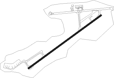
Mangalore
Airport details
| Country | India |
| State | Karnataka |
| Region | VO |
| Airspace | Chennai Ctr |
| Municipality | Mangaluru |
| Elevation | 335ft (102m) |
| Timezone | GMT +5.5 |
| Coordinates | 12.96206, 74.88978 |
| Magnetic var | |
| Type | land |
| Available since | X-Plane v10.40 |
| ICAO code | VOML |
| IATA code | IXE |
| FAA code | n/a |
Communication
| Mangalore Tower | 122.100 |
| Mangalore Approach | 122.100 |
Approach frequencies
| ILS-cat-I | RW24 | 110.1 | 18.00mi |
| 3° GS | RW24 | 110.1 | 18.00mi |
Nearby beacons
| code | identifier | dist | bearing | frequency |
|---|---|---|---|---|
| ML | MANGALORE NDB | 0.1 | 65° | 357 |
| MML | MANGALORE VOR/DME | 0.6 | 202° | 114.20 |
Instrument approach procedures
| runway | airway (heading) | route (dist, bearing) |
|---|---|---|
| RW06-Y | ETONA (32°) | ETONA ML503 (6mi, 325°) 2400ft |
| RW06-Y | ML504 (58°) | ML504 ML503 (6mi, 59°) 2400ft |
| RW06-Y | ML505 (83°) | ML505 ML503 (6mi, 145°) 2400ft |
| RNAV | ML503 2400ft ML502 (5mi, 59°) 2400ft VOML (8mi, 57°) 362ft ML506 (9mi, 61°) 1870ft ML507 (6mi, 146°) 2400ft ETONA (21mi, 239°) 2400ft ETONA (turn) 2400ft | |
| RW24-Y | ML404 (214°) | ML404 ML403 (6mi, 155°) 2400ft |
| RW24-Y | ML405 (268°) | ML405 ML403 (6mi, 333°) 2400ft |
| RNAV | ML403 2400ft ML402 (5mi, 239°) 2400ft VOML (7mi, 241°) 363ft ML406 (10mi, 237°) 1930ft ML407 (6mi, 148°) 2660ft ML405 (21mi, 59°) 4300ft ML405 (turn) 4300ft |
Disclaimer
The information on this website is not for real aviation. Use this data with the X-Plane flight simulator only! Data taken with kind consent from X-Plane 12 source code and data files. Content is subject to change without notice.
