Puttaparthi - Sri Sathya Sai
Airport details
| Country | India |
| State | Andhra Pradesh |
| Region | VO |
| Airspace | Chennai Ctr |
| Municipality | Puttaparthi |
| Elevation | 1558ft (475m) |
| Timezone | GMT +5.5 |
| Coordinates | 14.14797, 77.79044 |
| Magnetic var | |
| Type | land |
| Available since | X-Plane v10.40 |
| ICAO code | VOPN |
| IATA code | PUT |
| FAA code | n/a |
Communication
| Sri Sathya Sai Tower | 118.400 |
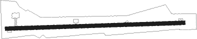
Runway info
| Runway 09 / 27 | ||
| length | 2234m (7329ft) | |
| bearing | 93° / 273° | |
| width | 47m (153ft) | |
| surface | asphalt | |
| displ threshold | 103m (338ft) / 0m (0ft) | |
Nearby beacons
| code | identifier | dist | bearing | frequency |
|---|---|---|---|---|
| SAI | SRI SATYA SAI NDB | 0.3 | 288° | 241 |
| BIB | BENGALURU VOR/DME | 45.4 | 170° | 114.50 |
| BIA | BENGALURU VOR/DME | 56.6 | 184° | 116.80 |
| CP | KADAPA NDB | 61.2 | 69° | 263 |
Disclaimer
The information on this website is not for real aviation. Use this data with the X-Plane flight simulator only! Data taken with kind consent from X-Plane 12 source code and data files. Content is subject to change without notice.