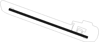
Dharavandhoo
Airport details
| Country | Maldives |
| State | Maalhosmadulu Dhekunuburi |
| Region | VR |
| Airspace | Male Ctr |
| Elevation | 4ft (1m) |
| Timezone | GMT +5 |
| Coordinates | 5.15605, 73.13021 |
| Magnetic var | |
| Type | land |
| Available since | X-Plane v11.05 |
| ICAO code | VRMD |
| IATA code | DRV |
| FAA code | n/a |
Communication
| Dharavandhoo Dharavandhoo Tower | 118.250 |
Runway info
| Runway 12 / 30 | ||
| length | 1201m (3940ft) | |
| bearing | 114° / 294° | |
| width | 30m (98ft) | |
| surface | asphalt | |
Nearby beacons
| code | identifier | dist | bearing | frequency |
|---|---|---|---|---|
| MLE | MALE VOR/DME | 61.7 | 157° | 114.70 |
Departure and arrival routes
| Transition altitude | 11000ft |
| Transition level | 13000ft |
| STAR starting points | distance | inbound heading | |
|---|---|---|---|
| RW12 | |||
| NASI1B | 14.0 | 338° | |
| RW30 | |||
| NASI1A | 14.0 | 338° | |
Instrument approach procedures
| runway | airway (heading) | route (dist, bearing) |
|---|---|---|
| RW12 | DEEDI (143°) | DEEDI ATURU (5mi, 204°) 1700ft |
| RW12 | JACKY (85°) | JACKY ATURU (5mi, 24°) 1700ft |
| RNAV | ATURU 1700ft MD171 (3mi, 114°) 1700ft VRMD (6mi, 114°) 46ft (4396mi, 266°) 3000ft UGITA (4397mi, 86°) 6000ft UGITA (turn) 6000ft | |
| RW30 | AMBOW (323°) | AMBOW BANDY (5mi, 24°) 1700ft |
| RW30 | HOSNY (265°) | HOSNY BANDY (5mi, 204°) 1700ft |
| RNAV | BANDY 1700ft MD031 (4mi, 294°) 1700ft VRMD (6mi, 294°) 46ft (4396mi, 266°) 3000ft UGITA (4397mi, 86°) 6000ft UGITA (turn) 6000ft |
Disclaimer
The information on this website is not for real aviation. Use this data with the X-Plane flight simulator only! Data taken with kind consent from X-Plane 12 source code and data files. Content is subject to change without notice.
