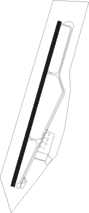
Nan
Airport details
| Country | Thailand |
| State | Nan Province |
| Region | VT |
| Airspace | Bangkok Ctr |
| Municipality | Du Tai |
| Elevation | 685ft (209m) |
| Timezone | GMT +7 |
| Coordinates | 18.80275, 100.78405 |
| Magnetic var | |
| Type | land |
| Available since | X-Plane v10.40 |
| ICAO code | VTCN |
| IATA code | NNT |
| FAA code | n/a |
Communication
| Nan Tower | 118.550 |
| Nan Approach | 120.250 |
Approach frequencies
| ILS-cat-I | RW02 | 110.3 | 18.00mi |
| 3.4° GS | RW02 | 110.3 | 18.00mi |
Nearby beacons
| code | identifier | dist | bearing | frequency |
|---|---|---|---|---|
| NAN | NAN VOR/DME | 0.3 | 347° | 115.70 |
| NN | NAN NDB | 0.3 | 30° | 355 |
| PAE | PHRAE VOR/DME | 53.3 | 223° | 111.80 |
| PR | PHRAE NDB | 53.7 | 223° | 340 |
| SAY | SAYABOULY NDB | 58.7 | 65° | 365 |
Instrument approach procedures
| runway | airway (heading) | route (dist, bearing) |
|---|---|---|
| RW02 | DUGEL (17°) | DUGEL 7000ft ASUBI (6mi, 6°) 5000ft |
| RW02 | INVAR (143°) | INVAR 7600ft EKIVI (21mi, 202°) 7000ft ASUBI (10mi, 110°) 5000ft |
| RW02 | MIBOB (90°) | MIBOB 7600ft EKIVI (11mi, 150°) 7000ft ASUBI (10mi, 110°) 5000ft |
| RW02 | OGENO (43°) | OGENO 7000ft ASUBI (8mi, 81°) 5000ft |
| RNAV | ASUBI 5000ft CN001 (5mi, 22°) 4000ft CN002 (6mi, 22°) 1800ft CN004 (3mi, 22°) 729ft (6018mi, 259°) 1600ft ASUBI (6014mi, 80°) 5000ft ASUBI (turn) 5000ft | |
| RW20 | ANUGU (142°) | ANUGU 9000ft GORDU (14mi, 127°) 7600ft CN203 (6mi, 110°) 5600ft RUTGI (6mi, 110°) 3800ft |
| RW20 | DUGEL (17°) | DUGEL 10000ft CN202 (22mi, 51°) 9000ft UPSOT (13mi, 22°) 7500ft RUTGI (12mi, 290°) 3800ft |
| RW20 | UKLOM (43°) | UKLOM 10000ft CN201 (18mi, 10°) 10000ft GORDU (17mi, 22°) 7600ft CN203 (6mi, 110°) 5600ft RUTGI (6mi, 110°) 3800ft |
| RNAV | RUTGI 3800ft CN204 (5mi, 202°) 2800ft CN205 (2mi, 202°) 2330ft CN206 (5mi, 202°) 732ft (6018mi, 259°) 3300ft GORDU (6010mi, 79°) 7600ft GORDU (turn) 7600ft |
Disclaimer
The information on this website is not for real aviation. Use this data with the X-Plane flight simulator only! Data taken with kind consent from X-Plane 12 source code and data files. Content is subject to change without notice.
