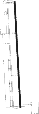
Nakhon Sawan Takhli Rtaf
Airport details
| Country | Thailand |
| State | Nakhon Sawan Province |
| Region | VT |
| Airspace | Bangkok Ctr |
| Elevation | 106ft (32m) |
| Timezone | GMT +7 |
| Coordinates | 15.27833, 100.30000 |
| Magnetic var | |
| Type | land |
| Available since | X-Plane v10.40 |
| ICAO code | VTPI |
| IATA code | TKH |
| FAA code | n/a |
Communication
| Nakhon Sawan Takhli RTAF Ground Control | 121.750 |
| Nakhon Sawan Takhli RTAF Tower | 133.250 |
| Nakhon Sawan Takhli RTAF Approach | 124.000 |
| Nakhon Sawan Takhli RTAF Departure | 134.100 |
Approach frequencies
| ILS-cat-I | RW18 | 108.7 | 18.00mi |
| 3° GS | RW18 | 108.7 | 18.00mi |
Nearby beacons
| code | identifier | dist | bearing | frequency |
|---|---|---|---|---|
| TKL | TAKHLI TACAN | 0.2 | 195° | 114.80 |
| TL | TAKHLI NDB | 0.2 | 226° | 350 |
| SPN | SA PRAN NAK (LOP BURI) VOR | 28.1 | 134° | 117.30 |
| LB | LOP BURI NDB | 31.9 | 139° | 280 |
| LOB | LOB (BANGKOK) TACAN | 31.9 | 138° | 116.80 |
Instrument approach procedures
| runway | airway (heading) | route (dist, bearing) |
|---|---|---|
| RW18 | MUDOR (151°) | MUDOR 4000ft ATRIL (7mi, 91°) 3200ft |
| RW18 | OMBIN (179°) | OMBIN 4000ft ATRIL (7mi, 178°) 3200ft |
| RW18 | VAPNO (210°) | VAPNO 4000ft ATRIL (7mi, 271°) 3200ft |
| RNAV | ATRIL 3200ft PI002 (6mi, 181°) 2000ft PI101 (6mi, 181°) 153ft (6001mi, 261°) 3000ft ATRIL (6001mi, 81°) 3200ft ATRIL (turn) 3200ft | |
| RW36 | DABES (37°) | DABES 4000ft DALBA (9mi, 91°) 3200ft |
| RW36 | POTAX (348°) | POTAX 4000ft DALBA (7mi, 323°) 3200ft |
| RW36 | PUGUL (333°) | PUGUL 4000ft DALBA (7mi, 271°) 3200ft |
| RNAV | DALBA 3200ft PI361 (6mi, 1°) 2000ft PI360 (6mi, 1°) 115ft (6001mi, 261°) 2000ft DALBA (6002mi, 81°) 3200ft DALBA (turn) 3200ft |
Disclaimer
The information on this website is not for real aviation. Use this data with the X-Plane flight simulator only! Data taken with kind consent from X-Plane 12 source code and data files. Content is subject to change without notice.
