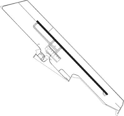
Krabi
Airport details
| Country | Thailand |
| State | Krabi Province |
| Region | VT |
| Airspace | Bangkok Ctr |
| Municipality | Krabi Noi |
| Elevation | 82ft (25m) |
| Timezone | GMT +7 |
| Coordinates | 8.10016, 98.98531 |
| Magnetic var | |
| Type | land |
| Available since | X-Plane v10.40 |
| ICAO code | VTSG |
| IATA code | KBV |
| FAA code | n/a |
Communication
| Krabi Ground Control | 121.900 |
| Krabi Tower | 118.600 |
| Krabi Approach | 120.050 |
Approach frequencies
| ILS-cat-I | RW32 | 110.1 | 18.00mi |
| 3.2° GS | RW32 | 110.1 | 18.00mi |
Nearby Points of Interest:
Ao Phang Nga National Park
-Wat Saraphimuk
Nearby beacons
| code | identifier | dist | bearing | frequency |
|---|---|---|---|---|
| KBI | KRABI VOR/DME | 0.6 | 313° | 111 |
| KB | KRABI NDB | 0.7 | 295° | 299 |
| PUT | PHUKET VOR/DME | 40.3 | 271° | 116.90 |
| TRN | TRANG VOR/DME | 52 | 133° | 116.60 |
| NKS | NAKHON SI THAMMARAT VOR/DME | 62.9 | 65° | 117.40 |
Departure and arrival routes
| Transition altitude | 11000ft |
| Transition level | 13000ft |
| SID end points | distance | outbound heading | |
|---|---|---|---|
| RW14 | |||
| SARE1G | 16mi | 7° | |
| OSPE1G | 20mi | 45° | |
| TUNR1G | 27mi | 133° | |
| TRN2D | 52mi | 133° | |
| EPGO1G | 18mi | 228° | |
| PUT2F | 40mi | 271° | |
| RW32 | |||
| LUXI1F | 23mi | 7° | |
| OSPE1F | 20mi | 45° | |
| TRN2C | 52mi | 133° | |
| TUNR1F | 27mi | 133° | |
| EPGO1F | 18mi | 228° | |
| PUT2E | 40mi | 271° | |
| STAR starting points | distance | inbound heading | |
|---|---|---|---|
| RW32 | |||
| EMRI1E | 10.3 | 92° | |
| NULM1E | 25.5 | 188° | |
| TUNR1E | 27.0 | 313° | |
Instrument approach procedures
| runway | airway (heading) | route (dist, bearing) |
|---|---|---|
| RW32 | BELMI (281°) | BELMI 5000ft MUNIA (10mi, 231°) 2500ft |
| RW32 | ROSIC (8°) | ROSIC 3100ft BENJA (6mi, 51°) 3100ft MUNIA (7mi, 51°) 2500ft |
| RNAV | MUNIA 2500ft SG002 (5mi, 321°) 2200ft SG001 (5mi, 321°) 620ft ROSIC (16mi, 194°) 3100ft ROSIC (turn) 3100ft |
Holding patterns
| STAR name | hold at | type | turn | heading* | altitude | leg | speed limit |
|---|---|---|---|---|---|---|---|
| EMRI1E | ROSIC | VHF | right | 231 (51)° | > 3100ft | 1.0min timed | 230 |
| NULM1E | BELMI | VHF | right | 51 (231)° | > 5000ft | 1.0min timed | 230 |
| *) magnetic outbound (inbound) holding course | |||||||
Disclaimer
The information on this website is not for real aviation. Use this data with the X-Plane flight simulator only! Data taken with kind consent from X-Plane 12 source code and data files. Content is subject to change without notice.