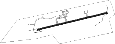
Trang
Airport details
| Country | Thailand |
| State | Trang Province |
| Region | VT |
| Airspace | Bangkok Ctr |
| Municipality | Khok Lo |
| Elevation | 65ft (20m) |
| Timezone | GMT +7 |
| Coordinates | 7.50862, 99.61578 |
| Magnetic var | |
| Type | land |
| Available since | X-Plane v10.40 |
| ICAO code | VTST |
| IATA code | TST |
| FAA code | n/a |
Communication
| Trang ATIS | 134.500 |
| Trang Tower | 118.400 |
| Trang Approach | 125.300 |
Approach frequencies
| ILS-cat-I | RW08 | 110.3 | 18.00mi |
| 3.5° GS | RW08 | 110.3 | 18.00mi |
Nearby Points of Interest:
Wat Nikhom Prathip
-Wat Khao Mueang Kao
-Wat Wang
-Wat Khuean Nang Kaeo
-Thale Noi Non-Hunting Area
Nearby beacons
| code | identifier | dist | bearing | frequency |
|---|---|---|---|---|
| TRN | TRANG VOR/DME | 0.6 | 88° | 116.60 |
| KB | KRABI NDB | 52.3 | 313° | 299 |
| KBI | KRABI VOR/DME | 52.3 | 313° | 111 |
| HTY | HAT YAI VOR/DME | 57.5 | 127° | 115.30 |
| SK | SONGKHLA NDB | 61.9 | 108° | 410 |
| SKL | SONGKHLA VOR/DME | 61.9 | 108° | 113.50 |
Departure and arrival routes
| Transition altitude | 11000ft |
| Transition level | 13000ft |
| SID end points | distance | outbound heading | |
|---|---|---|---|
| RW08 | |||
| NKS1A | 65mi | 18° | |
| HTY1A | 58mi | 127° | |
| PUT1C | 86mi | 295° | |
| RW26 | |||
| NKS1B | 65mi | 18° | |
| HTY1B | 58mi | 127° | |
| PUT1D | 86mi | 295° | |
Instrument approach procedures
| runway | airway (heading) | route (dist, bearing) |
|---|---|---|
| RW08 | HUNNY (306°) | HUNNY 7000ft GUZZO (15mi, 267°) 5500ft LAMNA (14mi, 267°) 3000ft TANYO (11mi, 355°) 3000ft |
| RW08 | NAKAR (199°) | NAKAR 8000ft PIONY (25mi, 246°) 5500ft TANYO (11mi, 167°) 3000ft |
| RW08 | NECON (115°) | NECON 7000ft PIONY (6mi, 115°) 5500ft TANYO (11mi, 167°) 3000ft |
| RW08 | RICOH (134°) | RICOH 7000ft PIONY (9mi, 173°) 5500ft TANYO (11mi, 167°) 3000ft |
| RW08 | SULEZ (165°) | SULEZ 8000ft PIONY (16mi, 229°) 5500ft TANYO (11mi, 167°) 3000ft |
| RNAV | TANYO 3000ft TSTW1 (5mi, 81°) 2600ft TSTWF (4mi, 81°) 1900ft VTST (5mi, 81°) 117ft (5978mi, 266°) 1000ft ZCUBA (5979mi, 86°) 3000ft ZCUBA (turn) 3000ft |
Disclaimer
The information on this website is not for real aviation. Use this data with the X-Plane flight simulator only! Data taken with kind consent from X-Plane 12 source code and data files. Content is subject to change without notice.