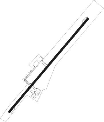
Sakon Nakhon Aero
Airport details
| Country | Thailand |
| State | Sakon Nakhon Province |
| Region | VT |
| Airspace | Bangkok Ctr |
| Municipality | Hang Hong |
| Elevation | 527ft (161m) |
| Timezone | GMT +7 |
| Coordinates | 17.19514, 104.11863 |
| Magnetic var | |
| Type | land |
| Available since | X-Plane v11.51r1 |
| ICAO code | VTUI |
| IATA code | SNO |
| FAA code | n/a |
Communication
| Sakon Nakhon Aero Tower | 119.650 |
| Sakon Nakhon Aero Approach | 123.350 |
Approach frequencies
| ILS-cat-I | RW23 | 110.3 | 18.00mi |
| 3° GS | RW23 | 110.3 | 18.00mi |
Nearby Points of Interest:
Wat Phra That Dum
-Phra That Phu Pek
-Wat Phra That Prasit
-Wat Phra That Renu
Nearby beacons
| code | identifier | dist | bearing | frequency |
|---|---|---|---|---|
| SN | SAKON NAKHON NDB | 0.2 | 296° | 365 |
| SKN | SAKON NAKHON VOR/DME | 1.5 | 44° | 114.20 |
| NKP | NAKHON PHANOM VOR/DME | 31.9 | 70° | 111.60 |
| NP | NAKHON PHANOM NDB | 32.2 | 69° | 383 |
| SAV | SAVANNAKHET VOR/DME | 53.2 | 134° | 113.50 |
Instrument approach procedures
| runway | airway (heading) | route (dist, bearing) |
|---|---|---|
| RW05 | MASIO (62°) | MASIO 7000ft PUNNA (17mi, 74°) 3200ft |
| RW05 | PATAN (100°) | PATAN 7000ft PUNNA (24mi, 124°) 3200ft |
| RW05 | VANON (249°) | VANON 4000ft DUPER (16mi, 216°) 4000ft FURNO (14mi, 226°) 4000ft PUNNA (10mi, 314°) 3200ft |
| RNAV | PUNNA 3200ft UI053 (6mi, 46°) 2500ft UI052 (1mi, 46°) 2100ft UI051 (5mi, 46°) 579ft (6214mi, 261°) 1500ft PUNNA (6206mi, 81°) 3200ft PUNNA (turn) 3200ft | |
| RW23 | MASIO (62°) | MASIO 7000ft NAKEE (19mi, 29°) 4000ft IRICA (20mi, 66°) 3000ft LAMMO (7mi, 134°) 2500ft |
| RW23 | NAKEE (102°) | NAKEE 4000ft IRICA (20mi, 66°) 3000ft LAMMO (7mi, 134°) 2500ft |
| RW23 | VANON (249°) | VANON 4000ft LAMMO (10mi, 269°) 2500ft |
| RNAV | LAMMO 2500ft UI232 (4mi, 226°) 2000ft UI231 (4mi, 226°) 831ft LAMMO (8mi, 46°) 2500ft LAMMO (turn) 2500ft |
Disclaimer
The information on this website is not for real aviation. Use this data with the X-Plane flight simulator only! Data taken with kind consent from X-Plane 12 source code and data files. Content is subject to change without notice.
