Bang Yai - Nonthaburi
Airport details
| Country | Thailand |
| State | Nonthaburi Province |
| Region | |
| Airspace | Bangkok Ctr |
| Municipality | Bang Yai Subdistrict |
| Elevation | 16ft (5m) |
| Timezone | GMT +7 |
| Coordinates | 13.83697, 100.33397 |
| Magnetic var | |
| Type | land |
| Available since | X-Plane v10.40 |
| ICAO code | VTW3 |
| IATA code | n/a |
| FAA code | n/a |
Communication
| Nonthaburi AWOS | 126.800 |
| Nonthaburi Tower | 123.800 |
Nearby Points of Interest:
Wat Anek Dittharam
-Wat Amphawan
-Wat Prang Luang
-Wat Lamut Nai
-Wat Samorakot
-Wat Kaeo Fa
-Wat Taling Chan
-Wat Chaiyaphrueksamala
-Wat Kanchanasinghat
-Wat Ratchadathitthan
-Wat Chaiyathit
-Wat Phawana Phirataram
-Wat Bang Khun Non
-Wat Si Sudaram
-Wat Ruak Bang Bamru
-Wat Sutthawat
-Wat Bot Inthara San Phet
-Wat Khuha Sawan
-Wat Yang Bang Chak
-Khlong Mon
-Wat Kamphaeng Bang Chak
-Wat Tong Sala Ngam
-Wat Pao Rohit
-Wat Phanu Rangsi
-Thonburi Railway Station
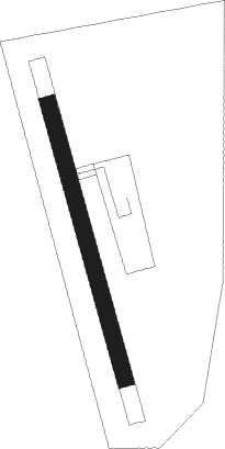
Runway info
| Runway 17 / 35 | ||
| length | 306m (1004ft) | |
| bearing | 169° / 349° | |
| width | 18m (59ft) | |
| surface | grass | |
| blast zone | 50m (164ft) / 50m (164ft) | |
Nearby beacons
| code | identifier | dist | bearing | frequency |
|---|---|---|---|---|
| BKK | BANGKOK VOR/DME | 15.6 | 78° | 117.70 |
| SVB | SUVARNABHUMI (BANGKOK) VOR/DME | 25.5 | 114° | 111.40 |
| KPS | KAMPHAENG SAEN (NAKHON PA VOR/DME | 29.6 | 311° | 114.50 |
| KPS | KAMPHAENG SAEN (NAKHON PATHOM) NDB | 29.7 | 311° | 251 |
Disclaimer
The information on this website is not for real aviation. Use this data with the X-Plane flight simulator only! Data taken with kind consent from X-Plane 12 source code and data files. Content is subject to change without notice.