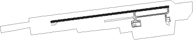
Da Lat - Lien Khuong
Airport details
| Country | Vietnam |
| State | Lâm Đồng Province |
| Region | VV |
| Airspace | Ho Chi Minh Ctr |
| Municipality | Đức Trọng District |
| Elevation | 3151ft (960m) |
| Timezone | GMT +7 |
| Coordinates | 11.75333, 108.36806 |
| Magnetic var | |
| Type | land |
| Available since | X-Plane v10.40 |
| ICAO code | VVDL |
| IATA code | DLI |
| FAA code | n/a |
Communication
Approach frequencies
| ILS-cat-I | RW09 | 110.9 | 18.00mi |
| 3° GS | RW09 | 110.9 | 18.00mi |
Nearby beacons
| code | identifier | dist | bearing | frequency |
|---|---|---|---|---|
| LKH | LIEN KHUONG VOR/DME | 0.7 | 274° | 112.30 |
| HYD | DALAT NDB | 1.8 | 267° | 312 |
| DL | DALAT NDB | 6 | 267° | 330 |
| CR | CAM RANH NDB | 52 | 74° | 414 |
| CRA | CAM RANH VOR/DME | 52.1 | 74° | 116.50 |
| PTH | PHANTHIET VOR/DME | 52.5 | 200° | 114.10 |
| BMT | BUON MA THUOT VOR/DME | 56.6 | 345° | 112.10 |
| HT | BUON MA THUOT NDB | 57.2 | 344° | 370 |
| BU | BUON MA THUOT NDB | 58.2 | 340° | 386 |
Departure and arrival routes
| Transition altitude | 9030ft |
| SID end points | distance | outbound heading | |
|---|---|---|---|
| RW09 | |||
| KANA2E | 27mi | 74° | |
| KANA2B | 16mi | 74° | |
| GIVI1A | 55mi | 236° | |
| DILI2B | 16mi | 237° | |
| HONG2B | 16mi | 343° | |
| KILE1A | 57mi | 345° | |
| RW27 | |||
| RANG1A | 52mi | 74° | |
| KANA2D, KANA2C, KANA2A | 16mi | 74° | |
| SAGU1A | 55mi | 236° | |
| DILI2D, DILI2C, DILI2A | 16mi | 237° | |
| HONG2D, HONG2E, HONG2A, HONG2C | 16mi | 343° | |
| STAR starting points | distance | inbound heading | |
|---|---|---|---|
| RW09 | |||
| DILI2A, DILI2B, DILI2E, DILI2G | 16.2 | 57° | |
| ROZA1A | 16.2 | 128° | |
| HONG2G, HONG2F, HONG2B, HONG2A | 16.2 | 163° | |
| KANA2G, KANA2F, KANA2B, KANA2A | 16.1 | 254° | |
| RW27 | |||
| DILI2F | 16.2 | 57° | |
| KILE1B | 16.2 | 189° | |
| KARD1A | 26.9 | 254° | |
Instrument approach procedures
| runway | airway (heading) | route (dist, bearing) |
|---|---|---|
| RW09-Y | DL501 (359°) | DL501 6000ft DL902 (16mi, 310°) 6000ft DL900 (5mi, 357°) 5900ft |
| RNAV | DL900 5900ft MIKAB (5mi, 87°) 4990ft DL500 (6mi, 87°) 3197ft DL501 (16mi, 174°) 6000ft DL501 (turn) 6000ft | |
| RW09-Z | DL901 (109°) | DL901 7000ft DL900 (5mi, 177°) 5900ft |
| RW09-Z | DL902 (65°) | DL902 7000ft DL900 (5mi, 357°) 5900ft |
| RNAV | DL900 5900ft MIKAB (5mi, 87°) 4990ft DL500 (6mi, 87°) 3197ft DL501 (16mi, 174°) 6000ft DL501 (turn) 6000ft | |
| RW27-Y | DL401 (352°) | DL401 6000ft DL271 (14mi, 35°) 6000ft DL270 (5mi, 357°) 5800ft |
| RNAV | DL270 5800ft TEMUD (3mi, 267°) 5510ft SDF01 (1mi, 267°) 4970ft VVDL (5mi, 267°) 3207ft DL400 (3mi, 267°) DL401 (16mi, 162°) 6000ft DL401 (turn) 6000ft | |
| RW27-Z | DL271 (294°) | DL271 7000ft DL270 (5mi, 357°) 5800ft |
| RW27-Z | KANAM (254°) | KANAM 8000ft SDF02 (4mi, 236°) 6800ft DL270 (3mi, 236°) 5800ft |
| RNAV | DL270 5800ft TEMUD (3mi, 267°) 5510ft SDF01 (1mi, 267°) 4970ft VVDL (5mi, 267°) 3207ft DL400 (3mi, 267°) DL401 (16mi, 162°) 6000ft DL401 (turn) 6000ft |
Holding patterns
| STAR name | hold at | type | turn | heading* | altitude | leg | speed limit |
|---|---|---|---|---|---|---|---|
| DILI2E | DILIN | VHF | left | 206 (26)° | 8000ft - 10000ft | 1.0min timed | 230 |
| DILI2F | DL271 | VHF | right | 177 (357)° | 7000ft - 14000ft | 1.0min timed | 230 |
| KARD1A | KANAM | VHF | right | 74 (254)° | 8000ft - 14000ft | 1.0min timed | 230 |
| KILE1B | KANAM | VHF | right | 74 (254)° | 8000ft - 14000ft | 1.0min timed | 230 |
| ROZA1A | ROZAN | VHF | right | 358 (178)° | 8000ft - 14000ft | 1.0min timed | 230 |
| *) magnetic outbound (inbound) holding course | |||||||
Disclaimer
The information on this website is not for real aviation. Use this data with the X-Plane flight simulator only! Data taken with kind consent from X-Plane 12 source code and data files. Content is subject to change without notice.