Pakokku - Pakhokku
Airport details
| Country | Myanmar |
| State | Magway |
| Region | VY |
| Airspace | Yangon Ctr |
| Municipality | Pakokku Township |
| Elevation | 350ft (107m) |
| Timezone | GMT +6.5 |
| Coordinates | 21.40533, 95.11134 |
| Magnetic var | |
| Type | land |
| Available since | X-Plane v10.40 |
| ICAO code | VYPU |
| IATA code | PKK |
| FAA code | n/a |
Communication
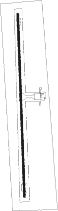
Runway info
| Runway 18 / 36 | ||
| length | 2720m (8924ft) | |
| bearing | 183° / 3° | |
| width | 30m (98ft) | |
| surface | concrete | |
Nearby beacons
| code | identifier | dist | bearing | frequency |
|---|---|---|---|---|
| BGN | BAGAN NDB | 17.1 | 219° | 335 |
| BGN | BAGAN VOR/DME | 17.4 | 218° | 114.90 |
| MY | MONYWAR NDB | 48.8 | 359° | 570 |
| MIA | MANDALAY NDB | 51.7 | 72° | 259 |
| MIA | MANDALAY VOR/DME | 51.8 | 71° | 116.30 |
| MKT | MEIKTILA NDB | 53 | 120° | 350 |
Disclaimer
The information on this website is not for real aviation. Use this data with the X-Plane flight simulator only! Data taken with kind consent from X-Plane 12 source code and data files. Content is subject to change without notice.