Tachileik
Airport details
| Country | Myanmar |
| State | Shan State |
| Region | VY |
| Airspace | Yangon Ctr |
| Municipality | Tachileik Township |
| Elevation | 1278ft (390m) |
| Timezone | GMT +6.5 |
| Coordinates | 20.48062, 99.93250 |
| Magnetic var | |
| Type | land |
| Available since | X-Plane v10.40 |
| ICAO code | VYTL |
| IATA code | THL |
| FAA code | n/a |
Communication
| Tachileik Tower | 118.700 |
Nearby Points of Interest:
Wat Phra That Doi Ku Kaeo
-Wat Chedi Chet Yot
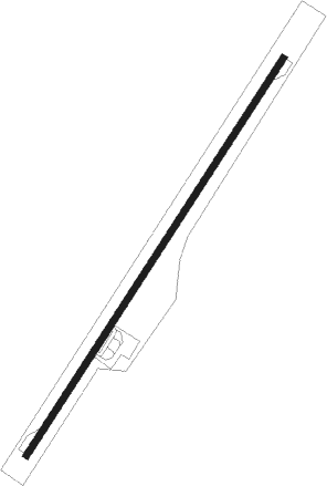
Runway info
| Runway 04 / 22 | ||
| length | 2138m (7014ft) | |
| bearing | 39° / 219° | |
| width | 31m (102ft) | |
| surface | asphalt | |
| blast zone | 79m (259ft) / 72m (236ft) | |
Nearby beacons
| code | identifier | dist | bearing | frequency |
|---|---|---|---|---|
| TL | TACHILEIK NDB | 0.1 | 41° | 375 |
| TCL | TACHILEIK VOR/DME | 0.2 | 45° | 114.50 |
| CT | CHIANG RAI NDB | 31.4 | 185° | 277 |
| CTR | CHIANG RAI VOR/DME | 32 | 185° | 116.50 |
| MS | MONG-HSAT NDB | 38 | 273° | 312 |
| KG | KENGTUNG NDB | 52.1 | 340° | 400 |
| KTG | KENGTUNG VOR/DME | 52.4 | 340° | 115.60 |
Disclaimer
The information on this website is not for real aviation. Use this data with the X-Plane flight simulator only! Data taken with kind consent from X-Plane 12 source code and data files. Content is subject to change without notice.