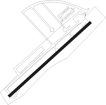
Waynesboro - Eagle's Nest
Airport details
| Country | United States of America |
| State | Virginia |
| Region | |
| Airspace | Washington Ctr |
| Municipality | Augusta County |
| Elevation | 1437ft (438m) |
| Timezone | GMT -5 |
| Coordinates | 38.07525, -78.94721 |
| Magnetic var | |
| Type | land |
| Available since | X-Plane v10.40 |
| ICAO code | W13 |
| IATA code | n/a |
| FAA code | W13 |
Communication
| Eagle's Nest AWOS-3 | 118.625 |
| Eagle's Nest CTAF/UNICOM | 123.050 |
Nearby Points of Interest:
Sugar Loaf Farm
-Rose Cliff
-Plumb House
-Waynesboro Downtown Historic District
-Crompton-Shenandoah Plant
-Port Republic Road Historic District
-Virginia Metalcrafters Historic District
-General Electric Specialty Control Plant
-Harper House (Stuarts Draft, Virginia)
-Swannanoa
-Rockfish Gap
-Chapel Hill (Mint Spring, Virginia)
-Valley Railroad Stone Bridge
-Crimora School
-Coiner House
-Oakdene (Staunton, Virginia)
-Thomas J. Michie House
-The Oaks
-J. C. M. Merrillat House
-Sears House
-Waverly Hill
-Arista Hoge House
-Catlett House
-Folly (Staunton, Virginia)
-Augusta County Courthouse
Nearby beacons
| code | identifier | dist | bearing | frequency |
|---|---|---|---|---|
| SH | STAUT(STAUNTON-WAYNESBORO-HARR NDB | 7.6 | 355° | 375 |
| MOL | MONTEBELLO VOR/DME | 12.9 | 222° | 115.30 |
| GVE | GORDONSVILLE VORTAC | 37.7 | 94° | 115.60 |
| LUA | CAVERNS (LURAY) NDB | 43.6 | 37° | 245 |
| LY | BOJAR (LYNCHBURG) NDB | 50.8 | 200° | 385 |
| LYH | LYNCHBURG VOR/DME | 51.1 | 199° | 109.20 |
| LDN | LINDEN VORTAC | 58.3 | 44° | 114.30 |
| RQY | RANDOLPH CO. (ELKINS) NDB | 65.2 | 312° | 284 |
| VIT | VINTON (ROANOKE) NDB | 68.6 | 227° | 277 |
| BKT | BLACKSTONE NDB | 71.3 | 136° | 326 |
Instrument approach procedures
| runway | airway (heading) | route (dist, bearing) |
|---|---|---|
| RW06 | OBEPE (58°) | OBEPE 6700ft |
| RNAV | OBEPE 6700ft SOSME (7mi, 58°) 4700ft WILIV (3mi, 58°) 3700ft W13 (7mi, 59°) 1476ft (4884mi, 116°) 1836ft ZEDPA (4872mi, 296°) 6300ft ZEDPA (turn) 6300ft | |
| RW24 | ZEDPA (239°) | ZEDPA 6300ft |
| RNAV | ZEDPA 6300ft NAYLO (7mi, 239°) 4400ft LIBMY (2mi, 239°) 4100ft W13 (8mi, 239°) 1470ft (4884mi, 116°) 1836ft OBEPE (4896mi, 296°) 6700ft OBEPE (turn) 6700ft |
Disclaimer
The information on this website is not for real aviation. Use this data with the X-Plane flight simulator only! Data taken with kind consent from X-Plane 12 source code and data files. Content is subject to change without notice.
