Monroe - Firstair Field
Airport details
| Country | United States of America |
| State | Washington |
| Region | |
| Airspace | Seattle Ctr |
| Municipality | Monroe |
| Elevation | 48ft (15m) |
| Timezone | GMT -8 |
| Coordinates | 47.87146, -121.99950 |
| Magnetic var | |
| Type | land |
| Available since | X-Plane v10.40 |
| ICAO code | W16 |
| IATA code | n/a |
| FAA code | W16 |
Communication
| Firstair Field CTAF | 122.900 |
Nearby Points of Interest:
Snohomish County Centennial Trail
-Horatio and Laura Allen Farm
-North Creek School
-McCabe Building
-Swalwell Cottage
-Dr. Reuben Chase House
-Lilly Kirk House
-Everett Carnegie Library
-Snohomish County Courthouse
-Everett City Hall
-Commerce Building
-Hewitt Avenue Historic District
-U.S. Post Office and Customshouse
-Community Center and War Memorial Building
-Sorenson House
-Rucker House
-Roland Hartley House
-William and Estella Adair Farm
-Weyerhaeuser Office Building
-North Coast Casket Company Building
-Marysville Opera House
-Harry Vanderbilt Wurdemann House
-St. Edward Seminary
-James W. Clise House
-Indian Shaker Church
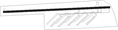
Runway info
| Runway 7 / 25 | ||
| length | 634m (2080ft) | |
| bearing | 91° / 271° | |
| width | 10m (34ft) | |
| surface | asphalt | |
| displ threshold | 0m (0ft) / 152m (499ft) | |
Nearby beacons
| code | identifier | dist | bearing | frequency |
|---|---|---|---|---|
| PAE | PAINE (EVERETT) VOR/DME | 11.5 | 280° | 110.60 |
| AW | WATON (ARLINGTON) NDB | 13.7 | 323° | 382 |
| SEA | SEATTLE VORTAC | 29 | 215° | 116.80 |
| CVV | PENN COVE VOR/DME | 36.7 | 297° | 117.20 |
| NUW | WHIDBEY ISLAND (OAK HARBO TACAN | 39.3 | 306° | 113.80 |
| BVS | SKAGIT/BAY VIEW (BURLINGTON) NDB | 39.5 | 325° | 240 |
| TCM | MC CHORD (TACOMA) TACAN | 47.5 | 213° | 109.60 |
| OLM | OLYMPIA VORTAC | 65.3 | 225° | 113.40 |
Disclaimer
The information on this website is not for real aviation. Use this data with the X-Plane flight simulator only! Data taken with kind consent from X-Plane 12 source code and data files. Content is subject to change without notice.