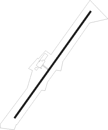
Mount Olive - Mount Olive Muni
Airport details
| Country | United States of America |
| State | North Carolina |
| Region | K7 |
| Airspace | Washington Ctr |
| Municipality | Wayne County |
| Elevation | 166ft (51m) |
| Timezone | GMT -5 |
| Coordinates | 35.22145, -78.03862 |
| Magnetic var | |
| Type | land |
| Available since | X-Plane v10.40 |
| ICAO code | W40 |
| IATA code | n/a |
| FAA code | W40 |
Communication
| Mount Olive Muni CTAF/UNICOM | 122.800 |
| Mount Olive Muni SEYMOUR JOHNSON Approach/Departure | 119.700 |
Nearby Points of Interest:
Solomon and Henry Weil Houses
-L. D. Giddens and Son Jewelry Store
-Goldsboro Union Station
-Odd Fellows Lodge
-First Presbyterian Church
-La Grange Historic District (North Carolina)
-La Grange Presbyterian Church
-Bentonville Battlefield
-Harper House
-Joshua James Blanchard House
-Kennedy Memorial Home Historic District
-Cedar Dell
-Francis Pugh House
-Fort Neoheroka
-Mitchelltown Historic District
-Harmony Hall
-Kinston Fire Station-City Hall
-American Tobacco Company Prizery
-Queen-Gordon Streets Historic District
-B. W. Canady House
-Baptist Parsonage
-Robert L. Blalock House
-Gen. Thomas Boykin House
-Hill–Grainger Historic District
-Hood-Strickland House
Nearby beacons
| code | identifier | dist | bearing | frequency |
|---|---|---|---|---|
| GSB | SEYMOUR JOHNSON TACAN | 7.5 | 31° | 116.50 |
| IS | STALS (KINSTON) NDB | 16.7 | 86° | 276 |
| CTZ | CLINTON NDB | 21.7 | 233° | 412 |
| JN | JURLY (SMITHFIELD) NDB | 24.2 | 303° | 263 |
| ISO | KINSTON VORTAC | 25.1 | 73° | 109.60 |
| OA | ELLAS (JACKSONVILLE) NDB | 32.7 | 145° | 261 |
| HQT | HARNETT (ERWIN) NDB | 33.6 | 288° | 417 |
| FGP | FORT BRAGG NDB | 38.3 | 264° | 393 |
| NCA | NEW RIVER TACAN | 42.6 | 131° | 115.40 |
| FAY | FAYETTEVILLE VOR/DME | 43.4 | 254° | 108.80 |
| AQE | ALWOOD (GREENVILLE) NDB | 43.7 | 54° | 230 |
| POB | POPE (FAYETTEVILLE) NDB | 44.9 | 270° | 338 |
| POB | POPE (FAYETTEVILLE) TACAN | 48.2 | 267° | 113.80 |
| TYI | TAR RIVER (ROCKY MOUNT) VORTAC | 48.2 | 24° | 117.80 |
| DIW | DIXON NDB | 48.6 | 138° | 198 |
| EW | KAFTI (NEW BERN) NDB | 48.6 | 102° | 362 |
| RNW | CHOCOWINITY NDB | 48.8 | 73° | 388 |
| EWN | NEW BERN VOR/DME | 49.5 | 98° | 113.60 |
| ILM | WILMINGTON VORTAC | 52.8 | 169° | 117 |
| RDU | RALEIGH-DURHAM VORTAC | 53.4 | 311° | 117.20 |
| LE | LEEVY (RALEIGH/DURHAM) NDB | 53.9 | 316° | 350 |
| GM | WILZE NDB | 54.2 | 166° | 205 |
| CPC | CAMP (WHITEVILLE) NDB | 65.9 | 215° | 227 |
Instrument approach procedures
| runway | airway (heading) | route (dist, bearing) |
|---|---|---|
| RW05 | BYRNE (75°) | BYRNE WIKOG (14mi, 83°) 2000ft YATUV (7mi, 98°) 2000ft |
| RW05 | WALLO (348°) | WALLO YATUV (16mi, 312°) 2000ft |
| RNAV | YATUV 2000ft BORRG (7mi, 46°) 1800ft CEGAV (2mi, 46°) 1060ft W40 (3mi, 46°) 226ft (4820mi, 114°) 900ft WIKOG (4833mi, 294°) 2000ft WIKOG (turn) | |
| RW23 | ESTER (220°) | ESTER ZOVEM (6mi, 207°) 2000ft |
| RNAV | ZOVEM 2000ft DALNN (7mi, 226°) 1800ft ZOTIL (3mi, 226°) 840ft W40 (2mi, 226°) 218ft (4820mi, 114°) 700ft WIKOG (4833mi, 294°) 2000ft WIKOG (turn) |
Disclaimer
The information on this website is not for real aviation. Use this data with the X-Plane flight simulator only! Data taken with kind consent from X-Plane 12 source code and data files. Content is subject to change without notice.