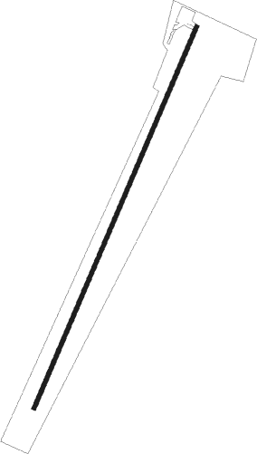
Clarksville - Marks Muni
Airport details
| Country | United States of America |
| State | Virginia |
| Region | K6 |
| Airspace | Washington Ctr |
| Municipality | Mecklenburg County |
| Elevation | 419ft (128m) |
| Timezone | GMT -5 |
| Coordinates | 36.59575, -78.56014 |
| Magnetic var | |
| Type | land |
| Available since | X-Plane v10.40 |
| ICAO code | W63 |
| IATA code | n/a |
| FAA code | n/a |
Communication
| MARKS MUNI CTAF | 122.900 |
Nearby Points of Interest:
Sunnyside (Clarksville, Virginia)
-Clarksville Historic District
-Judge Henry Wood, Jr. House
-Cedar Grove (Clarksville, Virginia)
-Clark Royster House
-Buckingham Courthouse Historic District
-Buffalo Springs Historical Archeological District
-Red Fox Farm
-On the Hill (Boydton, Virginia)
-Boydton Historic District
-Mecklenburg County Courthouse
-Boyd's Tavern
-Buckshoal Farm
-Burnside Plantation House
-Pool Rock Plantation
-Salem School
-Toombs Tobacco Farm
-Elm Hill
-Shadow Lawn (Chase City, Virginia)
-MacCallum More and Hudgins House Historic District
-Ashland
-Elm Hill Archaeological Site
-Eureka (Baskerville, Virginia)
-Reedy Creek Site
-Joseph B. Littlejohn House
Nearby beacons
| code | identifier | dist | bearing | frequency |
|---|---|---|---|---|
| HXO | HUNTSBORO (OXFORD) NDB | 17.9 | 191° | 271 |
| SBV | SOUTH BOSTON VORTAC | 22.4 | 280° | 110.40 |
| HUR | PERSON (ROXBORO) NDB | 32.7 | 234° | 220 |
| LVL | LAWRENCEVILLE VORTAC | 34.3 | 71° | 112.90 |
| DAN | DANVILLE VOR | 37.4 | 268° | 113.10 |
| BKT | BLACKSTONE NDB | 40.4 | 44° | 326 |
| LE | LEEVY (RALEIGH/DURHAM) NDB | 40.9 | 194° | 350 |
| RDU | RALEIGH-DURHAM VORTAC | 44.7 | 197° | 117.20 |
| LYH | LYNCHBURG VOR/DME | 51.1 | 314° | 109.20 |
| LY | BOJAR (LYNCHBURG) NDB | 51.7 | 314° | 385 |
| TYI | TAR RIVER (ROCKY MOUNT) VORTAC | 55.6 | 126° | 117.80 |
| FAK | FLAT ROCK VORTAC | 66 | 38° | 113.30 |
Instrument approach procedures
| runway | airway (heading) | route (dist, bearing) |
|---|---|---|
| RWNVA | ALDAN (62°) | ALDAN DIVTY (13mi, 84°) 3000ft |
| RWNVA | WUMVA (38°) | WUMVA DIVTY (9mi, 43°) 3000ft |
| RWNVA | YITUP (14°) | YITUP DIVTY (8mi, 344°) 3000ft |
| RNAV | DIVTY 3000ft KARBY (6mi, 33°) 2000ft W63 (5mi, 33°) 407ft (4855mi, 115°) 819ft HARVY (4852mi, 295°) 3000ft HARVY (turn) | |
| RWNVB | HARVY (210°) | HARVY 3000ft |
| RNAV | HARVY 3000ft HUDGI (5mi, 207°) 2000ft W63 (5mi, 213°) 450ft (4855mi, 115°) 819ft HARVY (4852mi, 295°) 3000ft HARVY (turn) |
Disclaimer
The information on this website is not for real aviation. Use this data with the X-Plane flight simulator only! Data taken with kind consent from X-Plane 12 source code and data files. Content is subject to change without notice.
