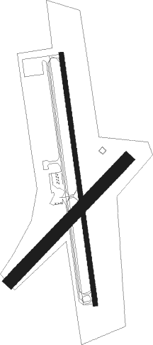
South Boston - William M Tuck
Airport details
| Country | United States of America |
| State | Virginia |
| Region | K6 |
| Airspace | Washington Ctr |
| Municipality | Halifax County |
| Elevation | 417ft (127m) |
| Timezone | GMT -5 |
| Coordinates | 36.70937, -78.84834 |
| Magnetic var | |
| Type | land |
| Available since | X-Plane v10.40 |
| ICAO code | W78 |
| IATA code | n/a |
| FAA code | n/a |
Communication
| William M Tuck CTAF/UNICOM | 122.800 |
Nearby Points of Interest:
Reedy Creek Site
-E. L. Evans House
-South Boston Historic District
-Seaton (South Boston, Virginia)
-Glennmary
-Berry Hill Plantation
-Town of Halifax Court House Historic District
-Halifax County Courthouse
-Buckshoal Farm
-Fourqurean House
-Tarover
-Glenwood
-Cedar Grove
-Pleasant Grove (Halifax, Virginia)
-Buffalo Springs Historical Archeological District
-Salem School
-Black Walnut (Clover, Virginia)
-Redfield (Oak Level, Virginia)
-Wade Archeological Site
-Toombs Tobacco Farm
-Holloway-Jones-Day House
-Holloway-Walker Dollarhite House
-Roanoke Plantation
-Carter's Tavern
-Mulberry Hill (Randolph, Virginia)

Nearby beacons
| code | identifier | dist | bearing | frequency |
|---|---|---|---|---|
| SBV | SOUTH BOSTON VORTAC | 8.2 | 258° | 110.40 |
| DAN | DANVILLE VOR | 24.9 | 254° | 113.10 |
| HXO | HUNTSBORO (OXFORD) NDB | 26.9 | 151° | 271 |
| HUR | PERSON (ROXBORO) NDB | 30.4 | 205° | 220 |
| LYH | LYNCHBURG VOR/DME | 37.6 | 325° | 109.20 |
| LY | BOJAR (LYNCHBURG) NDB | 38.2 | 324° | 385 |
| LVL | LAWRENCEVILLE VORTAC | 45.9 | 83° | 112.90 |
| BKT | BLACKSTONE NDB | 46 | 63° | 326 |
| LE | LEEVY (RALEIGH/DURHAM) NDB | 47.3 | 171° | 350 |
| SIF | SLAMMER (REIDSVILLE) NDB | 48.3 | 250° | 423 |
| RDU | RALEIGH-DURHAM VORTAC | 50.3 | 176° | 117.20 |
| HB | ALAMM NDB | 56.5 | 225° | 361 |
| LIB | LIBERTY VORTAC | 65.3 | 220° | 113 |
Instrument approach procedures
| runway | airway (heading) | route (dist, bearing) |
|---|---|---|
| RW01 | ALDAN (15°) | ALDAN BUSSI (9mi, 40°) 2600ft |
| RW01 | HARVY (264°) | HARVY CUVAR (18mi, 227°) 3000ft BUSSI (6mi, 267°) 2600ft |
| RW01 | SBV (78°) | SBV AAREN (10mi, 161°) 2600ft BUSSI (6mi, 87°) 2600ft |
| RNAV | BUSSI 2600ft DELET (6mi, 356°) 2100ft MOOEE (3mi, 356°) 1000ft W78 (2mi, 355°) 442ft (4869mi, 115°) 660ft HARVY (4852mi, 295°) 3000ft HARVY (turn) |
Disclaimer
The information on this website is not for real aviation. Use this data with the X-Plane flight simulator only! Data taken with kind consent from X-Plane 12 source code and data files. Content is subject to change without notice.