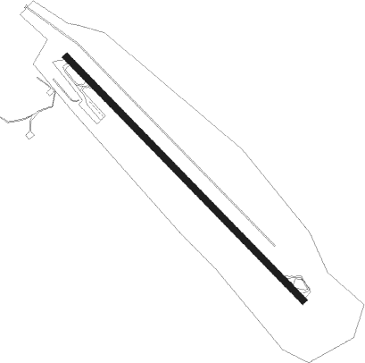
Crewe - Crewe Muni
Airport details
| Country | United States of America |
| State | Virginia |
| Region | K6 |
| Airspace | Washington Ctr |
| Municipality | Nottoway County |
| Elevation | 418ft (127m) |
| Timezone | GMT -5 |
| Coordinates | 37.18101, -78.09847 |
| Magnetic var | |
| Type | land |
| Available since | X-Plane v10.32 |
| ICAO code | W81 |
| IATA code | n/a |
| FAA code | n/a |
Communication
| CREWE MUNI CTAF/UNICOM | 122.800 |
Nearby beacons
| code | identifier | dist | bearing | frequency |
|---|---|---|---|---|
| BKT | BLACKSTONE NDB | 4.1 | 135° | 326 |
| LVL | LAWRENCEVILLE VORTAC | 23.7 | 152° | 112.90 |
| FAK | FLAT ROCK VORTAC | 24.5 | 38° | 113.30 |
| RIC | RICHMOND VORTAC | 41.8 | 68° | 114.10 |
| HPW | HOPEWELL VORTAC | 47.7 | 81° | 112 |
| GVE | GORDONSVILLE VORTAC | 50 | 356° | 115.60 |
| SBV | SOUTH BOSTON VORTAC | 53.4 | 241° | 110.40 |
| HXO | HUNTSBORO (OXFORD) NDB | 58.4 | 211° | 271 |
| HUR | PERSON (ROXBORO) NDB | 73.5 | 226° | 220 |
Instrument approach procedures
| runway | airway (heading) | route (dist, bearing) |
|---|---|---|
| RWNVA | FAK (218°) | FAK JASRA (19mi, 247°) 3000ft KIWCE (5mi, 236°) 3000ft |
| RWNVA | KIWCE (134°) | KIWCE 3000ft |
| RWNVA | YUDUG (55°) | YUDUG ODDUJ (17mi, 7°) 3000ft KIWCE (5mi, 56°) 3000ft |
| RNAV | KIWCE 3000ft IGEDE (6mi, 134°) 2100ft W81 (5mi, 134°) 1420ft (4837mi, 115°) 1420ft KIWCE (4846mi, 296°) 3000ft KIWCE (turn) | |
| RWNVB | MELIA (252°) | MELIA EHEKY (13mi, 222°) 3000ft |
| RNAV | EHEKY 3000ft FIBIP (5mi, 286°) 1900ft OBSUE (3mi, 299°) 1420ft (4837mi, 115°) 1420ft HESUV (4840mi, 295°) KIWCE (9mi, 319°) 3000ft KIWCE (turn) |
Disclaimer
The information on this website is not for real aviation. Use this data with the X-Plane flight simulator only! Data taken with kind consent from X-Plane 12 source code and data files. Content is subject to change without notice.
