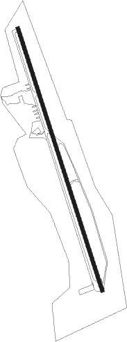
Timberlake - New London
Airport details
| Country | United States of America |
| State | Virginia |
| Region | K6 |
| Airspace | Washington Ctr |
| Municipality | Bedford County |
| Elevation | 849ft (259m) |
| Timezone | GMT -5 |
| Coordinates | 37.27173, -79.33590 |
| Magnetic var | |
| Type | land |
| Available since | X-Plane v10.40 |
| ICAO code | W90 |
| IATA code | n/a |
| FAA code | W90 |
Communication
| New London CTAF/UNICOM | 122.800 |
| New London ROANOKE Approach/Departure | 135.000 |
Nearby Points of Interest:
Liberty Hall (Forest, Virginia)
-Federal Hill
-Caryswood
-Pleasant View (Forest, Virginia)
-Walnut Hill (Lynchburg, Virginia)
-Bellevue (Goode, Virginia)
-Bellevue Rural Historic District
-Brook Hill Farm
-Rothsay (Forest, Virginia)
-Woodbourne (Forest, Virginia)
-Old Rectory
-Rosedale
-Elk Hill (Forest, Virginia)
-Samuel Miller House
-Montview
-Avoca (Altavista, Virginia)
-South River Friends Meetinghouse
-Sandusky House
-Cifax Rural Historic District
-Otterburn
-John D. Ballard House
-Burks-Guy-Hagen House
-Avenel (Bedford, Virginia)
-Mansion Truss Bridge
-Elks National Home
Nearby beacons
| code | identifier | dist | bearing | frequency |
|---|---|---|---|---|
| LY | BOJAR (LYNCHBURG) NDB | 4.4 | 96° | 385 |
| LYH | LYNCHBURG VOR/DME | 4.8 | 100° | 109.20 |
| VIT | VINTON (ROANOKE) NDB | 26.4 | 263° | 277 |
| ODR | WOODRUM (ROANOKE) VOR | 30.8 | 275° | 114.90 |
| ROA | ROANOKE VOR/DME | 35.3 | 276° | 109.40 |
| SBV | SOUTH BOSTON VORTAC | 39 | 152° | 110.40 |
| MOL | MONTEBELLO VOR/DME | 39.3 | 20° | 115.30 |
| DAN | DANVILLE VOR | 42.2 | 180° | 113.10 |
| UV | BALES (MARTINSVILLE) NDB | 49.5 | 220° | 396 |
| SIF | SLAMMER (REIDSVILLE) NDB | 57.2 | 206° | 423 |
| SH | STAUT(STAUNTON-WAYNESBORO-HARR NDB | 58.6 | 22° | 375 |
| HXO | HUNTSBORO (OXFORD) NDB | 67.7 | 144° | 271 |
Instrument approach procedures
| runway | airway (heading) | route (dist, bearing) |
|---|---|---|
| RW18 | LUCLI (185°) | LUCLI JOPIS (5mi, 241°) 4600ft |
| RW18 | PROSE (116°) | PROSE GIPKE (13mi, 88°) 5700ft JOPIS (3mi, 88°) 4600ft |
| RNAV | JOPIS 4600ft FABSA (3mi, 163°) 3800ft CIYAT (3mi, 163°) 2900ft W90 (6mi, 163°) 871ft (4897mi, 115°) 1242ft ZOTOB (4895mi, 295°) AYARA (13mi, 236°) 4000ft AYARA (turn) | |
| RW36 | AYARA (42°) | AYARA ZOPLU (12mi, 76°) 3000ft |
| RW36 | SYCAM (346°) | SYCAM ZOPLU (6mi, 349°) 3000ft |
| RNAV | ZOPLU 3000ft ZOTOB (5mi, 343°) 2100ft W90 (4mi, 343°) 810ft (4897mi, 115°) 1242ft CIYAT (4899mi, 295°) LUCLI (9mi, 20°) 4700ft LUCLI (turn) |
Disclaimer
The information on this website is not for real aviation. Use this data with the X-Plane flight simulator only! Data taken with kind consent from X-Plane 12 source code and data files. Content is subject to change without notice.