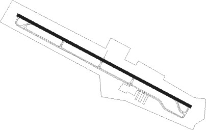
Petersburg - Grant County
Airport details
| Country | United States of America |
| State | West Virginia |
| Region | K6 |
| Airspace | Washington Ctr |
| Municipality | Grant County |
| Elevation | 961ft (293m) |
| Timezone | GMT -5 |
| Coordinates | 38.99495, -79.14586 |
| Magnetic var | |
| Type | land |
| Available since | X-Plane v10.40 |
| ICAO code | W99 |
| IATA code | n/a |
| FAA code | n/a |
Communication
| Grant County AWOS 3 | 124.475 |
| Grant County CTAF/UNICOM | 122.800 |
Approach frequencies
| LDA | RW31 | 111.5 | 18.00mi |
Nearby Points of Interest:
Grant County Courthouse
-The Manor
-Hickory Hill (Petersburg, West Virginia)
-Wilson-Kuykendall Farm
-Old Judy Church
-Thomas Maslin House
-Old Stone Tavern
-Old Hardy County Courthouse
-Moorefield Historic District
-Judge J. W. F. Allen House
-P.W. Inskeep House
-Willow Wall
-Lighthorse Harry Lee Cabin
-Buena Vista Farms
-Fort Pleasant
-Garrett VanMeter House
-Canaan Valley
-John Mathias House
-Pendleton County Poor Farm
-Herman August Meyer House
-Germany Valley
-Day-Vandevander Mill
-Davis Coal and Coke Company Administrative Building
-Cottrill Opera House
-Thomas Commercial Historic District
Nearby beacons
| code | identifier | dist | bearing | frequency |
|---|---|---|---|---|
| ESL | KESSEL VOR/DME | 15.6 | 34° | 110.80 |
| RQY | RANDOLPH CO. (ELKINS) NDB | 33.8 | 262° | 284 |
| LUA | CAVERNS (LURAY) NDB | 36.1 | 114° | 245 |
| GRV | DME | 38.6 | 8° | 112.30 |
| EKN | ELKINS VORTAC | 44.7 | 265° | 114.20 |
| LDN | LINDEN VORTAC | 44.7 | 99° | 114.30 |
| MGW | MORGANTOWN VOR/DME | 47.3 | 308° | 111.60 |
| SH | STAUT(STAUNTON-WAYNESBORO-HARR NDB | 48.4 | 167° | 375 |
| IHD | INDIAN HEAD VORTAC | 59.6 | 348° | 108.20 |
| VV | CAMOR (CONNELLSVILLE) NDB | 60.1 | 326° | 299 |
Instrument approach procedures
| runway | airway (heading) | route (dist, bearing) |
|---|---|---|
| RW31-Y | CELAG (263°) | CELAG WOLUB (8mi, 202°) 5700ft |
| RW31-Y | HAVEV (308°) | HAVEV WOLUB (8mi, 22°) 5700ft |
| RW31-Y | WOLUB (284°) | WOLUB 5700ft |
| RNAV | WOLUB 5700ft PADOH (7mi, 284°) 4500ft FEKUP (3mi, 284°) 3260ft YIKRU (5mi, 284°) 1186ft (4899mi, 116°) 1363ft ESL (4894mi, 296°) 5000ft ESL (turn) | |
| RW31-Z | CELAG (263°) | CELAG WOLUB (8mi, 202°) 5700ft |
| RW31-Z | HAVEV (308°) | HAVEV WOLUB (8mi, 22°) 5700ft |
| RW31-Z | WOLUB (284°) | WOLUB 5700ft |
| RNAV | WOLUB 5700ft PADOH (7mi, 284°) 4500ft FEKUP (3mi, 284°) 3260ft YIKRU (5mi, 284°) 1186ft (4899mi, 116°) 2200ft ESL (4894mi, 296°) 5000ft ESL (turn) | |
| RWNVC | ESL (214°) | ESL ZOKUD (18mi, 262°) 6300ft ZOKUD (turn) 5600ft |
| RWNVC | YANUL (129°) | YANUL ZOKUD (5mi, 130°) 5600ft |
| RNAV | ZOKUD 5600ft WUKAK (5mi, 130°) 5600ft JUDUM (2mi, 130°) 4800ft IYEPU (3mi, 130°) 3600ft CUVOL (2mi, 130°) 3040ft ODGUE (2mi, 130°) 2880ft (4901mi, 116°) 2900ft ESL (4894mi, 296°) 5000ft ESL (turn) |
Disclaimer
The information on this website is not for real aviation. Use this data with the X-Plane flight simulator only! Data taken with kind consent from X-Plane 12 source code and data files. Content is subject to change without notice.
