Waikabubak-sumba Island - Tambolaka
Airport details
| Country | Indonesia |
| State | East Nusa Tenggara |
| Region | WA |
| Airspace | Ujung Pandang Ctr |
| Municipality | Sumba Barat Daya |
| Elevation | 161ft (49m) |
| Timezone | GMT +8 |
| Coordinates | -9.40902, 119.24215 |
| Magnetic var | |
| Type | land |
| Available since | X-Plane v10.40 |
| ICAO code | WADT |
| IATA code | TMC |
| FAA code | n/a |
Communication
| Tambolaka Tambolaka CTAF | 122.500 |
Runway info
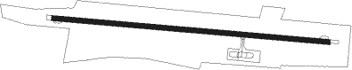
| Runway 10 / 28 | ||
| length | 2301m (7549ft) | |
| bearing | 99° / 279° | |
| width | 45m (148ft) | |
| surface | asphalt | |
Nearby beacons
| code | identifier | dist | bearing | frequency |
|---|---|---|---|---|
| TBK | TAMBOLAKA VOR/DME | 0.3 | 85° | 113.10 |
| WK | TAMBOLAKA NDB | 0.5 | 123° | 201 |
| NMA | BIMA VOR/DME | 61.8 | 328° | 115.10 |
| LB | LABUHAN BAJO NDB | 67.1 | 35° | 238 |
| LBJ | LABUAN BAJO VOR/DME | 67.5 | 35° | 112.60 |
Disclaimer
The information on this website is not for real aviation. Use this data with the X-Plane flight simulator only! Data taken with kind consent from X-Plane 12 source code and data files. Content is subject to change without notice.