Semarang-java Island - Semarang Ahmad Yani
Airport details
| Country | Indonesia |
| State | Central Java |
| Region | WA |
| Airspace | Jakarta Ctr |
| Municipality | Semarang |
| Elevation | 13ft (4m) |
| Timezone | GMT +7 |
| Coordinates | -6.97639, 110.37722 |
| Magnetic var | |
| Type | land |
| Available since | X-Plane v11.00r2 |
| ICAO code | WAHS |
| IATA code | SRG |
| FAA code | n/a |
Communication
| Semarang Ahmad Yani ATIS | 126.000 |
| Semarang Ahmad Yani Yani Tower | 122.300 |
| Semarang Ahmad Yani Semarang Approach | 120.300 |
Approach frequencies
| ILS-cat-I | RW13 | 109.9 | 18.00mi |
| 3° GS | RW13 | 109.9 | 18.00mi |
Nearby Points of Interest:
Semarang
-Borobudur Temple Compounds
-Sangiran
Runway info
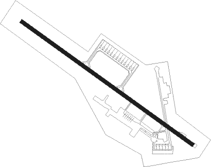
| Runway 13 / 31 | ||
| length | 2663m (8737ft) | |
| bearing | 130° / 310° | |
| width | 45m (148ft) | |
| surface | asphalt | |
| displ threshold | 0m (0ft) / 119m (390ft) | |
| blast zone | 83m (272ft) / 0m (0ft) | |
Nearby beacons
| code | identifier | dist | bearing | frequency |
|---|---|---|---|---|
| ANY | SEMARANG VOR/DME | 0.2 | 60° | 115.20 |
| OC | SEMARANG NDB | 0.3 | 188° | 350 |
| PI | SEMARANG NDB | 25.9 | 117° | 265 |
| SO | SOLO NDB | 38.9 | 145° | 255 |
| SLO | SOLO VOR/DME | 40.4 | 142° | 116.30 |
| OF | YOGYAKARTA NDB | 48.6 | 176° | 270 |
| JOG | YOGYAKARTA VOR/DME | 49.6 | 185° | 112.80 |
Departure and arrival routes
| Transition altitude | 11000ft |
| Transition level | 13000ft |
| SID end points | distance | outbound heading | |
|---|---|---|---|
| RW13 | |||
| PURW2C | 26mi | 120° | |
| KIDE2A | 75mi | 303° | |
| RAFI1A | 256mi | 343° | |
| RW31 | |||
| PURW3E | 26mi | 120° | |
| KIDE3B | 75mi | 303° | |
| RAFI1B | 256mi | 343° | |
| STAR starting points | distance | inbound heading | |
|---|---|---|---|
| RW13 | |||
| PIAL3A | 74.7 | 99° | |
| RAFI1C | 256.2 | 163° | |
| LASE3A | 76.8 | 254° | |
| PURW2A | 25.9 | 300° | |
| RW31 | |||
| PIAL1B | 74.7 | 99° | |
| RAFI1D | 256.2 | 163° | |
| LASE1B | 76.8 | 254° | |
| PURW1B | 25.9 | 300° | |
Instrument approach procedures
| runway | airway (heading) | route (dist, bearing) |
|---|---|---|
| RW13 | DAKEG (131°) | DAKEG 3000ft HS401 (3mi, 132°) 2300ft |
| RNAV | HS401 2300ft HS402 (4mi, 130°) 1600ft WAHS (6mi, 131°) 61ft DAKEG (13mi, 311°) 3000ft |
Holding patterns
| STAR name | hold at | type | turn | heading* | altitude | leg | speed limit |
|---|---|---|---|---|---|---|---|
| BA1A | DAKEG | VHF | left | 309 (129)° | > 3000ft | 1.0min timed | ICAO rules |
| BA1B | POXOT | VHF | right | 104 (284)° | > 3000ft | 1.0min timed | ICAO rules |
| LASE1B | POXOT | VHF | right | 104 (284)° | > 3000ft | 1.0min timed | ICAO rules |
| LASE3A | DAKEG | VHF | left | 309 (129)° | > 3000ft | 1.0min timed | ICAO rules |
| PIAL1B | POXOT | VHF | right | 104 (284)° | > 3000ft | 1.0min timed | ICAO rules |
| PIAL3A | DAKEG | VHF | left | 309 (129)° | > 3000ft | 1.0min timed | ICAO rules |
| PURW1B | POXOT | VHF | right | 104 (284)° | > 3000ft | 1.0min timed | ICAO rules |
| PURW2A | DAKEG | VHF | left | 309 (129)° | > 3000ft | 1.0min timed | ICAO rules |
| RAFI1C | DAKEG | VHF | left | 309 (129)° | > 3000ft | 1.0min timed | ICAO rules |
| RAFI1D | POXOT | VHF | right | 104 (284)° | > 3000ft | 1.0min timed | ICAO rules |
| *) magnetic outbound (inbound) holding course | |||||||
Disclaimer
The information on this website is not for real aviation. Use this data with the X-Plane flight simulator only! Data taken with kind consent from X-Plane 12 source code and data files. Content is subject to change without notice.