Gotalalamo-morotai Island - Pitu
Airport details
| Country | Indonesia |
| State | North Maluku |
| Region | |
| Airspace | Ujung Pandang Ctr |
| Municipality | Pulau Morotai |
| Elevation | 47ft (14m) |
| Timezone | GMT +9 |
| Coordinates | 2.04584, 128.31477 |
| Magnetic var | |
| Type | land |
| Available since | X-Plane v10.40 |
| ICAO code | WAMR |
| IATA code | OTI |
| FAA code | n/a |
Communication
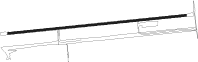
Runway info
| Runway 09 / 27 | ||
| length | 2207m (7241ft) | |
| bearing | 89° / 269° | |
| width | 29m (95ft) | |
| surface | asphalt | |
Nearby beacons
| code | identifier | dist | bearing | frequency |
|---|---|---|---|---|
| OX | PITU (MOROTAI) NDB | 1.5 | 272° | 295 |
| KAO | KUABANG VOR/DME | 57.5 | 206° | 113.70 |
Disclaimer
The information on this website is not for real aviation. Use this data with the X-Plane flight simulator only! Data taken with kind consent from X-Plane 12 source code and data files. Content is subject to change without notice.