Madiun-java Island - Madiun Iswahyudi
Airport details
| Country | Indonesia |
| State | East Java |
| Region | WA |
| Airspace | Ujung Pandang Ctr |
| Municipality | Magetan |
| Elevation | 358ft (109m) |
| Timezone | GMT +7 |
| Coordinates | -7.61000, 111.43333 |
| Magnetic var | |
| Type | land |
| Available since | X-Plane v10.40 |
| ICAO code | WARI |
| IATA code | n/a |
| FAA code | n/a |
Communication
| Madiun Iswahyudi MADIUN Approach | 120.800 |
Nearby Points of Interest:
Sangiran
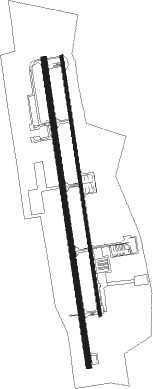
Runway info
Runway 17L / 35R  | ||
| length | 2588m (8491ft) | |
| bearing | 176° / 356° | |
| width | 28m (92ft) | |
| surface | asphalt | |
| displ threshold | 0m (0ft) / 160m (525ft) | |
| Runway 17 / 35 | ||
| length | 3070m (10072ft) | |
| bearing | 176° / 356° | |
| width | 57m (187ft) | |
| surface | asphalt | |
| blast zone | 0m (0ft) / 102m (335ft) | |
Nearby beacons
| code | identifier | dist | bearing | frequency |
|---|---|---|---|---|
| IWY | ISWAHYUDI (MADIUN) TACAN | 0.2 | 27° | 114.80 |
| AR | ISWAHYUDI (MADIUN) NDB | 3.3 | 178° | 315 |
| BA | BLORA (SEMARANG) NDB | 37 | 359° | 240 |
| SLO | SOLO VOR/DME | 38.5 | 279° | 116.30 |
| SO | SOLO NDB | 41.3 | 278° | 255 |
| PI | SEMARANG NDB | 47.6 | 303° | 265 |
| OF | YOGYAKARTA NDB | 60.3 | 260° | 270 |
Disclaimer
The information on this website is not for real aviation. Use this data with the X-Plane flight simulator only! Data taken with kind consent from X-Plane 12 source code and data files. Content is subject to change without notice.