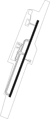
Miri
Airport details
| Country | Malaysia |
| State | Sarawak |
| Region | WB |
| Airspace | Kota Kinabalu Ctr |
| Municipality | Miri |
| Elevation | 59ft (18m) |
| Timezone | GMT +8 |
| Coordinates | 4.33698, 113.99048 |
| Magnetic var | |
| Type | land |
| Available since | X-Plane v10.40 |
| ICAO code | WBGR |
| IATA code | MYY |
| FAA code | n/a |
Communication
| Miri ATIS | 127.000 |
| Miri Ground Control | 121.900 |
| Miri Tower | 123.300 |
| Miri Approach | 122.900 |
| Miri Approach | 122.700 |
Approach frequencies
| ILS-cat-I | RW02 | 110.1 | 18.00mi |
| 3° GS | RW02 | 110.1 | 18.00mi |
Nearby beacons
| code | identifier | dist | bearing | frequency |
|---|---|---|---|---|
| VMI | MIRI VOR/DME | 0.2 | 78° | 112.40 |
| VMY | MIRI VOR/DME | 2.1 | 200° | 113.60 |
| AKI | ANDUKI NDB | 28.8 | 52° | 250 |
| VZU | MULU VOR/DME | 51.5 | 111° | 112.80 |
| BRU | BRUNEI VOR/DME | 62.5 | 59° | 112 |
| BR | BRUNEI NDB | 64.1 | 58° | 318 |
Departure and arrival routes
| Transition altitude | 11000ft |
| Transition level | 13000ft |
| SID end points | distance | outbound heading | |
|---|---|---|---|
| RW02 | |||
| GODO1A, GODO1C | 13mi | 64° | |
| EXUG1C, EXUG1A | 13mi | 71° | |
| ESLA1C, ESLA1A | 20mi | 114° | |
| DUGE1C, DUGE1A | 41mi | 204° | |
| DOXE1A, DOXE1C | 41mi | 219° | |
| BIPA1C, BIPA1A | 41mi | 231° | |
| BEVD1A, BEVD1C | 40mi | 255° | |
| AROV1C, AROV1A | 40mi | 267° | |
| ASAK1C, ASAK1A | 40mi | 281° | |
| RW20 | |||
| GODO1D, GODO1B | 13mi | 64° | |
| EXUG1D, EXUG1B | 13mi | 71° | |
| ESLA1B, ESLA1D | 20mi | 114° | |
| DUGE1B, DUGE1D | 41mi | 204° | |
| DOXE1B, DOXE1D | 41mi | 219° | |
| BIPA1B, BIPA1D | 41mi | 231° | |
| BEVD1D, BEVD1B | 40mi | 255° | |
| AROV1D, AROV1B | 40mi | 267° | |
| ASAK1B, ASAK1D | 40mi | 281° | |
| STAR starting points | distance | inbound heading | |
|---|---|---|---|
| RW02 | |||
| DUGE1E, DUGE1G | 41.0 | 24° | |
| DOXE1G, DOXE1E | 40.9 | 39° | |
| BIPA1E, BIPA1G | 40.7 | 51° | |
| BEVD1G, BEVD1E | 40.3 | 75° | |
| ASAK1G, ASAK1E | 39.9 | 101° | |
| GODO1G, GODO1E | 12.5 | 244° | |
| EXUG1E, EXUG1G | 12.8 | 251° | |
| ESLA1G, ESLA1E | 20.1 | 294° | |
| RW20 | |||
| DUGE1H, DUGE1F | 41.0 | 24° | |
| DOXE1H, DOXE1F | 40.9 | 39° | |
| BIPA1F, BIPA1H | 40.7 | 51° | |
| BEVD1H, BEVD1F | 40.3 | 75° | |
| ASAK1H, ASAK1F | 39.9 | 101° | |
| GODO1H, GODO1F | 12.5 | 244° | |
| EXUG1F, EXUG1H | 12.8 | 251° | |
| ESLA1H, ESLA1F | 20.1 | 294° | |
Instrument approach procedures
| runway | airway (heading) | route (dist, bearing) |
|---|---|---|
| RW02-Z | GUTOS (254°) | GUTOS 7000ft LUVSA (24mi, 235°) 3000ft GR507 (6mi, 233°) 3000ft GR506 (5mi, 309°) 1700ft ATNEL (3mi, 25°) 1000ft |
| RW02-Z | NONIS (77°) | NONIS 4500ft SALAV (4mi, 96°) 3500ft GR519 (8mi, 96°) 2200ft GR517 (2mi, 95°) 2000ft GR516 (turn) 2000ft GR500 (2mi, 74°) 1400ft ATNEL (2mi, 42°) 1000ft |
| RW02-Z | OMDIK (50°) | OMDIK 5000ft GR518 (12mi, 58°) 2200ft GR500 (4mi, 58°) 1400ft ATNEL (2mi, 42°) 1000ft |
| RW02-Z | PAKTO (73°) | PAKTO 5000ft ISVIL (6mi, 90°) 3500ft GR520 (7mi, 90°) 2200ft GR516 (2mi, 89°) 2000ft GR500 (2mi, 74°) 1400ft ATNEL (2mi, 42°) 1000ft |
| RNAV | ATNEL 1000ft WBGR (5mi, 23°) 111ft GR508 (4mi, 27°) GR509 (6mi, 108°) LUVSA (9mi, 191°) 3000ft | |
| RW20-Z | ONUGI (72°) | ONUGI 7000ft NUTBU (3mi, 42°) 7000ft LURMI (11mi, 42°) 3600ft GR512 (3mi, 44°) 3100ft GR511 (4mi, 74°) 2800ft ADGIT (6mi, 155°) 1000ft |
| RW20-Z | SAROV (131°) | SAROV 4000ft OSRIK (9mi, 103°) 2900ft GR511 (2mi, 105°) 2800ft ADGIT (6mi, 155°) 1000ft |
| RW20-Z | VIPED (239°) | VIPED 7000ft GODOM (13mi, 234°) 3500ft MESOB (6mi, 266°) 2000ft GR510 (2mi, 244°) 1600ft ADGIT (2mi, 225°) 1000ft |
| RNAV | ADGIT 1000ft WBGR (3mi, 209°) 108ft GR513 (7mi, 203°) GR514 (10mi, 304°) LURMI (7mi, 42°) 3600ft |
Holding patterns
| STAR name | hold at | type | turn | heading* | altitude | leg | speed limit |
|---|---|---|---|---|---|---|---|
| ASAK1F | GOTNI | VHF | right | 353 (173)° | > 3000ft | 1.0min timed | 230 |
| BEVD1F | GOTNI | VHF | right | 353 (173)° | > 3000ft | 1.0min timed | 230 |
| BIPA1E | ADNOX | VHF | right | 205 (25)° | > 3000ft | 1.0min timed | 230 |
| BIPA1F | GOTNI | VHF | right | 353 (173)° | > 3000ft | 1.0min timed | 230 |
| DOXE1E | ADNOX | VHF | right | 205 (25)° | > 3000ft | 1.0min timed | 230 |
| DOXE1F | GOTNI | VHF | right | 353 (173)° | > 3000ft | 1.0min timed | 230 |
| DUGE1E | ADNOX | VHF | right | 205 (25)° | > 3000ft | 1.0min timed | 230 |
| DUGE1F | GOTNI | VHF | right | 353 (173)° | > 3000ft | 1.0min timed | 230 |
| ESLA1F | GOTNI | VHF | right | 353 (173)° | > 3000ft | 1.0min timed | 230 |
| EXUG1F | GOTNI | VHF | right | 353 (173)° | > 3000ft | 1.0min timed | 230 |
| GODO1F | GOTNI | VHF | right | 353 (173)° | > 3000ft | 1.0min timed | 230 |
| *) magnetic outbound (inbound) holding course | |||||||
Disclaimer
The information on this website is not for real aviation. Use this data with the X-Plane flight simulator only! Data taken with kind consent from X-Plane 12 source code and data files. Content is subject to change without notice.