Waupun
Airport details
| Country | United States of America |
| State | Wisconsin |
| Region | |
| Airspace | Chicago Ctr |
| Municipality | Town of Trenton |
| Elevation | 938ft (286m) |
| Timezone | GMT -6 |
| Coordinates | 43.62529, -88.76629 |
| Magnetic var | |
| Type | land |
| Available since | X-Plane v10.40 |
| ICAO code | WI07 |
| IATA code | n/a |
| FAA code | WI07 |
Communication
Nearby Points of Interest:
Martin K. Dahl House
-Waupun Correctional Institution
-Waupun Public Library
-Zion Congregational Church
-Brandon Village Hall and Library
-St. Andrew's Church
-Weyenberg Shoe Factory
-Williams Free Library
-Chicago, Milwaukee and St. Paul Railway Company Passenger Depot
-Hutchinson Memorial Library
-Sisson's Peony Gardens
-Daniel C. Van Brunt House
-Horicon State Bank
-White Limestone School
-Main Street Historic District
-Hollenstein Wagon and Carriage Factory
-Baptist Church
-St. Peter's Episcopal Church
-First Congregational Church
-Jacob Woodruff House
-W. H. Boller Meat Market and Residence
-Green Lake County Courthouse
-Green Lake Village Hall
-Chicago and Northwestern Railroad Depot (Fond du Lac, Wisconsin)
-Octagon House
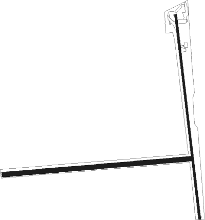
Runway info
Runway 18 / 36  | ||
| length | 1037m (3402ft) | |
| bearing | 177° / 357° | |
| width | 11m (35ft) | |
| surface | asphalt | |
| Runway 09 / 27 | ||
| length | 939m (3081ft) | |
| bearing | 90° / 270° | |
| width | 23m (75ft) | |
| surface | grass | |
Nearby beacons
| code | identifier | dist | bearing | frequency |
|---|---|---|---|---|
| UNU | JUNEAU NDB | 12.1 | 162° | 344 |
| OS | POBER (OSHKOSH) NDB | 17.4 | 40° | 395 |
| OSH | OSHKOSH VORTAC | 23.7 | 30° | 116.75 |
| RYV | ROCK RIVER (WATERTOWN) NDB | 27.1 | 175° | 371 |
| BJB | WEST BEND VOR | 30.4 | 108° | 109.80 |
| BAE | BADGER (MILWAUKEE) VOR/DME | 37 | 137° | 116.40 |
| MSN | MADISON VORTAC | 38.1 | 230° | 108.60 |
| AQ | KOOKY (APPLETON) NDB | 38.8 | 32° | 407 |
| FAH | (SHEBOYGAN) DME | 40.7 | 81° | 110 |
| DLL | DELLS (BARABOO) VORTAC | 43.6 | 266° | 117 |
| LJT | (MILWAUKEE) DME | 44.4 | 125° | 115.65 |
| SG | DEPRE (GREEN BAY) NDB | 53.8 | 39° | 332 |
| GR | FAMIS (GREEN BAY) NDB | 53.9 | 33° | 356 |
| BUU | (BURLINGTON) DME | 59.7 | 154° | 114.50 |
| GRB | GREEN BAY VORTAC | 61 | 32° | 115.50 |
| HRK | (RACINE) DME | 66.5 | 132° | 117.70 |
| RA | PASER (RACINE) NDB | 68.1 | 137° | 206 |
Disclaimer
The information on this website is not for real aviation. Use this data with the X-Plane flight simulator only! Data taken with kind consent from X-Plane 12 source code and data files. Content is subject to change without notice.