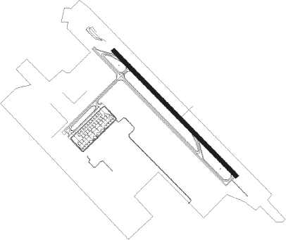
Jatiwangi - Kertajati Intl
Airport details
| Country | Indonesia |
| State | West Java |
| Region | |
| Airspace | Jakarta Ctr |
| Municipality | Majalengka Regency |
| Elevation | 132ft (40m) |
| Timezone | GMT +7 |
| Coordinates | -6.64833, 108.15417 |
| Magnetic var | |
| Type | land |
| Available since | X-Plane v10.40 |
| ICAO code | WICA |
| IATA code | n/a |
| FAA code | n/a |
Communication
| Kertajati Intl Tower SRY | 118.250 |
| Kertajati Intl Tower | 124.300 |
Approach frequencies
| ILS-cat-I | RW14 | 109.5 | 18.00mi |
| 3° GS | RW14 | 109.5 | 18.00mi |
Nearby beacons
| code | identifier | dist | bearing | frequency |
|---|---|---|---|---|
| KTJ | MAJALENGKA VOR/DME | 0.8 | 87° | 112.10 |
| IMU | INDRAMAYU VOR/DME | 23.4 | 28° | 116.40 |
| PG | CIREBON NDB | 23.8 | 106° | 276 |
| CA | CIREBON NDB | 24.3 | 97° | 365 |
| OZ | KALIJATI NDB | 28.7 | 282° | 385 |
| OY | BANDUNG NDB | 34.4 | 241° | 300 |
| YY | BANDUNG NDB | 38.6 | 248° | 205 |
| BND | BANDUNG VOR/DME | 40.7 | 250° | 117 |
| TM | TASIKMALAYA NDB | 42 | 172° | 391 |
| PW | PURWAKARTA NDB | 42.2 | 277° | 250 |
Departure and arrival routes
| Transition altitude | 11000ft |
| Transition level | 13000ft |
| SID end points | distance | outbound heading | |
|---|---|---|---|
| RW14 | |||
| CLP1J | 80mi | 138° | |
| CKG1A | 101mi | 286° | |
| TKG1A | 195mi | 295° | |
| RW32 | |||
| CKG1B, CKG1C | 101mi | 286° | |
| TKG1B, TKG1C | 195mi | 295° | |
| STAR starting points | distance | inbound heading | |
|---|---|---|---|
| RW14 | |||
| DAGO2C | 40.7 | 70° | |
| HLM1C | 78.9 | 107° | |
| RW32 | |||
| DAGO2D | 40.7 | 70° | |
| HLM1D | 78.9 | 107° | |
Instrument approach procedures
| runway | airway (heading) | route (dist, bearing) |
|---|---|---|
| RW14 | KECAP (142°) | KECAP 3000ft RUSMI (3mi, 137°) 2100ft |
| RNAV | RUSMI 2100ft SAHDI (3mi, 140°) 1700ft WICA (5mi, 146°) 178ft (6488mi, 274°) 1000ft KECAP (6481mi, 93°) 3000ft KECAP (turn) 3000ft | |
| RW32 | KECAP (142°) | KECAP 8000ft PAREV (6mi, 138°) 6500ft SEDAN (11mi, 167°) 5000ft GUNRA (5mi, 140°) 3500ft PODAB (5mi, 50°) 2300ft |
| RNAV | PODAB 2300ft MINIS (4mi, 320°) 1700ft WICA (6mi, 315°) 184ft PAREV (5mi, 326°) KECAP (6mi, 318°) 5000ft KECAP (turn) 8000ft |
Holding patterns
| STAR name | hold at | type | turn | heading* | altitude | leg | speed limit |
|---|---|---|---|---|---|---|---|
| CA1Q | KECAP | VHF | left | 318 (138)° | > 3000ft | 1.0min timed | ICAO rules |
| CA1R | KECAP | VHF | left | 318 (138)° | > 3000ft | 1.0min timed | ICAO rules |
| DAGO2C | KECAP | VHF | left | 318 (138)° | > 3000ft | 1.0min timed | ICAO rules |
| DAGO2D | KECAP | VHF | left | 318 (138)° | > 3000ft | 1.0min timed | ICAO rules |
| HLM1C | KECAP | VHF | left | 318 (138)° | > 3000ft | 1.0min timed | ICAO rules |
| HLM1D | KECAP | VHF | left | 318 (138)° | > 3000ft | 1.0min timed | ICAO rules |
| *) magnetic outbound (inbound) holding course | |||||||
Disclaimer
The information on this website is not for real aviation. Use this data with the X-Plane flight simulator only! Data taken with kind consent from X-Plane 12 source code and data files. Content is subject to change without notice.
