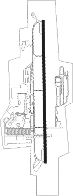
Butterworth
Airport details
| Country | Malaysia |
| State | Penang |
| Region | WM |
| Airspace | Kuala Lumpur Ctr |
| Municipality | Butterworth |
| Elevation | 11ft (3m) |
| Timezone | GMT +8 |
| Coordinates | 5.45892, 100.39197 |
| Magnetic var | |
| Type | land |
| Available since | X-Plane v10.40 |
| ICAO code | WMKB |
| IATA code | BWH |
| FAA code | n/a |
Communication
| Butterworth ATIS | 122.750 |
| Butterworth Ground Control | 134.600 |
| Butterworth Tower | 118.300 |
| Butterworth Approach | 123.200 |
| Butterworth Approach | 125.800 |
| Butterworth Approach | 128.500 |
| Butterworth Departure | 128.500 |
Nearby beacons
| code | identifier | dist | bearing | frequency |
|---|---|---|---|---|
| VBT | BUTTERWORTH VORTAC | 1 | 4° | 113.30 |
| VPG | PENANG VOR/DME | 13.3 | 216° | 116.20 |
| AT | ALOR STAR NDB | 42 | 358° | 385 |
| VAS | ALOR SETAR VOR/DME | 43.6 | 0° | 113.60 |
| BET | BETONG (YALA) VOR/DME | 49 | 67° | 113.10 |
| VPL | LANGKAWI VOR/DME | 66.2 | 324° | 114.10 |
| VIH | IPOH VOR/DME | 67.7 | 142° | 117.30 |
Disclaimer
The information on this website is not for real aviation. Use this data with the X-Plane flight simulator only! Data taken with kind consent from X-Plane 12 source code and data files. Content is subject to change without notice.