Lake Stevens - Frontier Airpark
Airport details
| Country | United States of America |
| State | Washington |
| Region | K1 |
| Airspace | Seattle Ctr |
| Municipality | Snohomish County |
| Elevation | 479ft (146m) |
| Timezone | GMT -8 |
| Coordinates | 48.11042, -122.06284 |
| Magnetic var | |
| Type | land |
| Available since | X-Plane v10.40 |
| ICAO code | WN53 |
| IATA code | n/a |
| FAA code | WN53 |
Communication
Nearby Points of Interest:
Marysville Opera House
-Indian Shaker Church
-North Coast Casket Company Building
-St. Anne's Roman Catholic Church
-Weyerhaeuser Office Building
-Swalwell Cottage
-McCabe Building
-Roland Hartley House
-Community Center and War Memorial Building
-Commerce Building
-Hewitt Avenue Historic District
-Everett Carnegie Library
-Snohomish County Courthouse
-Everett City Hall
-U.S. Post Office and Customshouse
-Rucker House
-Snohomish County Centennial Trail
-Stanwood IOOF Public Hall
-Three Fingers Lookout
-Cama Beach State Park
-North Creek School
-Lilly Kirk House
-Dr. Reuben Chase House
-Andrew Carnegie Library
-Sorenson House
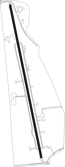
Runway info
| Runway 16 / 34 | ||
| length | 1152m (3780ft) | |
| bearing | 169° / 349° | |
| width | 15m (50ft) | |
| surface | asphalt | |
| displ threshold | 296m (971ft) / 70m (230ft) | |
Nearby beacons
| code | identifier | dist | bearing | frequency |
|---|---|---|---|---|
| AW | WATON (ARLINGTON) NDB | 4.1 | 249° | 382 |
| PAE | PAINE (EVERETT) VOR/DME | 14.3 | 228° | 110.60 |
| BVS | SKAGIT/BAY VIEW (BURLINGTON) NDB | 25.7 | 315° | 240 |
| CVV | PENN COVE VOR/DME | 27.6 | 281° | 117.20 |
| NUW | WHIDBEY ISLAND (OAK HARBO TACAN | 28.1 | 292° | 113.80 |
| SEA | SEATTLE VORTAC | 41.7 | 200° | 116.80 |
| FHR | FRIDAY HARBOR NDB | 45.3 | 293° | 284 |
| HUH | WHATCOM VORTAC | 54.1 | 328° | 113 |
| XX | ABBOTSFORD NDB | 56.9 | 335° | 344 |
| TCM | MC CHORD (TACOMA) TACAN | 60.1 | 203° | 109.60 |
| WC | WHITE ROCK NDB | 60.1 | 322° | 332 |
Disclaimer
The information on this website is not for real aviation. Use this data with the X-Plane flight simulator only! Data taken with kind consent from X-Plane 12 source code and data files. Content is subject to change without notice.