Clarksburg - Rexroad
Airport details
| Country | United States of America |
| State | West Virginia |
| Region | |
| Airspace | Washington Ctr |
| Municipality | Barbour County |
| Elevation | 1350ft (411m) |
| Timezone | GMT -5 |
| Coordinates | 39.13955, -80.21254 |
| Magnetic var | |
| Type | land |
| Available since | X-Plane v10.40 |
| ICAO code | WV47 |
| IATA code | n/a |
| FAA code | WV47 |
Communication
| Rexroad Tower | 128.200 |
Nearby Points of Interest:
Templemoor
-J.N.B. Crim House
-Carrollton Covered Bridge
-Lost Creek Baltimore and Ohio Railroad Depot
-Daniel Bassel House
-Adaland
-Philippi B & O Railroad Station
-Whitescarver Hall
-Barbour County Courthouse
-Peck-Crim-Chesser House
-William Post Mansion
-Downtown Buckhannon Historic District
-Southern Methodist Church Building
-Buckhannon Central Residential Historical District
-Governor Joseph Johnson House
-Agnes Howard Hall
-Watters Smith Memorial State Park
-Waldomore
-Anna Jarvis House
-Jackson's Mill
-Jackson's Mill State 4-H Camp Historic District
-Weston Downtown Residential Historic District
-Weston Colored School
-Jonathan M. Bennett House
-Bernard E. Wilmoth House
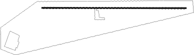
Runway info
| Runway 10 / 28 | ||
| length | 1150m (3773ft) | |
| bearing | 94° / 274° | |
| width | 9m (30ft) | |
| surface | asphalt | |
Nearby beacons
| code | identifier | dist | bearing | frequency |
|---|---|---|---|---|
| CKB | CLARKSBURG VOR/DME | 7.2 | 334° | 112.60 |
| EKN | ELKINS VORTAC | 14.5 | 153° | 114.20 |
| RQY | RANDOLPH CO. (ELKINS) NDB | 22.1 | 125° | 284 |
| MGW | MORGANTOWN VOR/DME | 29.9 | 40° | 111.60 |
| VV | CAMOR (CONNELLSVILLE) NDB | 49.6 | 32° | 299 |
| AIR | BELLAIRE VOR/DME | 59.6 | 325° | 117.10 |
| IHD | INDIAN HEAD VORTAC | 63.8 | 46° | 108.20 |
Disclaimer
The information on this website is not for real aviation. Use this data with the X-Plane flight simulator only! Data taken with kind consent from X-Plane 12 source code and data files. Content is subject to change without notice.