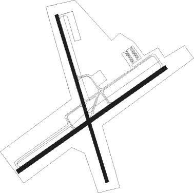
Lake Wales - Lake Wales Muni
Airport details
| Country | United States of America |
| State | Florida |
| Region | K7 |
| Airspace | Miami Oceanic Ctr |
| Municipality | Lake Wales |
| Elevation | 125ft (38m) |
| Timezone | GMT -5 |
| Coordinates | 27.89389, -81.62041 |
| Magnetic var | |
| Type | land |
| Available since | X-Plane v10.40 |
| ICAO code | X07 |
| IATA code | n/a |
| FAA code | n/a |
Communication
| Lake Wales Muni CTAF/UNICOM | 122.800 |
| Lake Wales Muni TAMPA Approach/Departure | 120.650 |
Nearby Points of Interest:
Lake Wales City Hall
-Lake Wales Commercial Historic District
-North Avenue Historic District
-G. V. Tillman House
-First Baptist Church
-Lake Wales Historic Residential District
-C. L. Johnson House
-B. K. Bullard House
-Church of the Holy Spirit
-Mountain Lake Colony House
-Casa De Josefina
-Mountain Lake Estates Historic District
-El Retiro
-Lake of the Hills Community Club
-Babson Park Woman's Club
-Old Dundee Atlantic Coast Line Railroad Depot
-Winter Haven Heights Historic Residential District
-Downtown Winter Haven Historic District
-Pope Avenue Historic District
-Lawrence Brown House
-John J. Swearingen House
-Northeast Bartow Residential District
-Benjamin Franklin Holland House
-South Bartow Residential District
-Interlaken Historic Residential District

Nearby beacons
| code | identifier | dist | bearing | frequency |
|---|---|---|---|---|
| LAL | LAKELAND VORTAC | 21.6 | 283° | 116 |
| OR | HERNY (ORLANDO) NDB | 38.1 | 17° | 221 |
| ORL | ORLANDO VORTAC | 41.7 | 24° | 112.20 |
| MCF | MACDILL (TAMPA) TACAN | 47.4 | 268° | 111 |
| TP | COSME (TAMPA) NDB | 49.3 | 282° | 368 |
| MLB | MELBOURNE VOR/DME | 53.7 | 78° | 115.85 |
| SRQ | SARASOTA VOR/DME | 58 | 243° | 117 |
| PGD | PUNTA GORDA VOR | 61.9 | 201° | 110.20 |
Instrument approach procedures
| runway | airway (heading) | route (dist, bearing) |
|---|---|---|
| RW06 | CROWD (56°) | CROWD ZETOK (11mi, 50°) 2000ft |
| RW06 | LAL (103°) | LAL EXHUD (6mi, 133°) 2700ft ZETOK (10mi, 133°) 2000ft |
| RW06 | ZETOK (62°) | ZETOK 2000ft |
| RNAV | ZETOK 2000ft WIRGA (7mi, 62°) 1800ft LIDDE (3mi, 62°) 700ft X07 (2mi, 61°) 168ft (4961mi, 109°) 1000ft ZETOK (4970mi, 289°) 2000ft ZETOK (turn) | |
| RW24 | ODDEL (246°) | ODDEL WOSAV (15mi, 248°) 2000ft |
| RW24 | WOSAV (243°) | WOSAV 2000ft |
| RNAV | WOSAV 2000ft JETUD (7mi, 242°) 1800ft OTWUR (3mi, 242°) 820ft X07 (2mi, 243°) 166ft (4961mi, 109°) 527ft WOSAV (4951mi, 289°) 2000ft WOSAV (turn) |
Disclaimer
The information on this website is not for real aviation. Use this data with the X-Plane flight simulator only! Data taken with kind consent from X-Plane 12 source code and data files. Content is subject to change without notice.