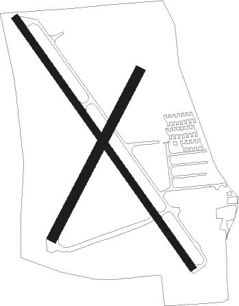
Titusville - Arthur Dunn Air Park
Airport details
| Country | United States of America |
| State | Florida |
| Region | K7 |
| Airspace | Miami Oceanic Ctr |
| Municipality | Titusville |
| Elevation | 27ft (8m) |
| Timezone | GMT -5 |
| Coordinates | 28.62255, -80.83541 |
| Magnetic var | |
| Type | land |
| Available since | X-Plane v10.40 |
| ICAO code | X21 |
| IATA code | n/a |
| FAA code | n/a |
Communication
| Arthur Dunn Air Park AWOS 3 | 119.725 |
| Arthur Dunn Air Park CTAF/UNICOM | 123.000 |
| Arthur Dunn Air Park ORLANDO Approach/Departure | 134.950 |
Nearby Points of Interest:
La Grange Church and Cemetery
-Titusville Commercial District
-Pritchard House
-Wager House
-Spell House
-Windover Archaeological Site
-Haulover Canal
-Vehicle Assembly Building
-John F. Kennedy Space Center MPS
-Launch Control Center
-Launch Complex 39 Press Site
-Central Instrumentation Facility
-Kennedy Space Center Launch Complex 39B
-KSC Headquarters Building
-Operations and Checkout Building
-St. Luke's Episcopal Church and Cemetery
-Kennedy Space Center Launch Complex 39
-City Point Community Church
-Seminole Rest
-J. R. Field Homestead
-Dr. George E. Hill House
-Cape Canaveral Space Force Station
-Porcher House
-Aladdin Theater
-Valencia Subdivision Residential District
Nearby beacons
| code | identifier | dist | bearing | frequency |
|---|---|---|---|---|
| COF | PATRICK (COCOA) TACAN | 25.9 | 150° | 115 |
| ORL | ORLANDO VORTAC | 26.7 | 261° | 112.20 |
| OR | HERNY (ORLANDO) NDB | 32.3 | 259° | 221 |
| MLB | MELBOURNE VOR/DME | 32.8 | 159° | 115.85 |
| OMN | ORMOND BEACH VORTAC | 43.3 | 338° | 112.60 |
| TRV | TREASURE (VERO BEACH) VORTAC | 59.5 | 160° | 117.30 |
Instrument approach procedures
| runway | airway (heading) | route (dist, bearing) |
|---|---|---|
| RWNVA | OAKIE (157°) | OAKIE 2000ft |
| RNAV | OAKIE 2000ft YONLI (10mi, 162°) 1800ft X21 (4mi, 146°) 77ft (4923mi, 109°) 430ft KIQTU (4920mi, 289°) INDIA (8mi, 167°) 2000ft INDIA (turn) | |
| RWNVB | INDIA (340°) | INDIA 2000ft |
| RNAV | INDIA 2000ft KIQTU (8mi, 347°) 1700ft X21 (4mi, 326°) 79ft (4923mi, 109°) 430ft YONLI (4925mi, 290°) OAKIE (10mi, 342°) 2000ft OAKIE (turn) |
Disclaimer
The information on this website is not for real aviation. Use this data with the X-Plane flight simulator only! Data taken with kind consent from X-Plane 12 source code and data files. Content is subject to change without notice.

