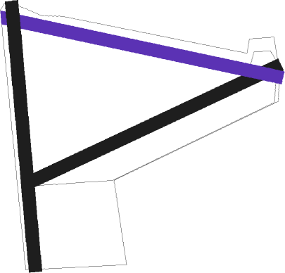
Ince Blundell
Airport details
| Country | United Kingdom |
| State | England |
| Region | |
| Airspace | London Ctr |
| Municipality | Sefton |
| Elevation | 13ft (4m) |
| Timezone | GMT +0 |
| Coordinates | 53.53510, -3.03292 |
| Magnetic var | |
| Type | land |
| Available since | X-Plane v10.40 |
| ICAO code | X4IN |
| IATA code | n/a |
| FAA code | n/a |
Communication
Nearby Points of Interest:
Sefton Coast
-Ince Blundell Hall
-Crosby Hall, Merseyside
-Crosby United Reformed Church
-Formby Hall
-Merchant Taylors' Girls' School
-Crosby Town Hall
-Linacre Methodist Mission
-Bootle Town Hall
-Bootle War Memorial
-Statue of Edward VII
-Simmonswood Hall
-Scarisbrick Hall
-Church of St Teresa of Avila, Birkdale
-St Peter and Paul's Catholic Church
-St Joseph's Church, Birkdale
-Lifeboat Memorial, Southport
-Tate & Lyle Sugar Silo
-St Hilary's Church, Wallasey
-Manor Church Centre, Egremont
-English Martyrs' Church, Wallasey
-The Atkinson
-Wallasey Memorial Unitarian Church
-Southport Town Hall
-Monumental Obelisk, Southport
Nearby beacons
| code | identifier | dist | bearing | frequency |
|---|---|---|---|---|
| WAL | WALLASEY VOR/DME | 9.3 | 215° | 114.10 |
| WTN | WARTON TACAN | 13.4 | 36° | 113.20 |
| BPL | BLACKPOOL NDB | 14.2 | 1° | 318 |
| WTN | WARTON NDB | 14.5 | 40° | 337 |
| LPL | LIVERPOOL NDB | 16 | 122° | 349 |
| HAW | HAWARDEN NDB | 21.4 | 171° | 340 |
| WHI | WHITEGATE NDB | 25.6 | 131° | 368 |
| MCT | MANCHESTER VOR/DME | 29.5 | 103° | 113.55 |
| POL | POLE HILL VOR/DME | 35.3 | 77° | 112.10 |
| WL | BARROW (WALNEY ISLAND) NDB | 36.5 | 339° | 385 |
| SWB | SHAWBURY VOR/DME | 46.2 | 153° | 116.80 |
| WPL | WELSHPOOL NDB | 54.5 | 188° | 323 |
Disclaimer
The information on this website is not for real aviation. Use this data with the X-Plane flight simulator only! Data taken with kind consent from X-Plane 12 source code and data files. Content is subject to change without notice.

