Homestead - Homestead General Avn
Airport details
| Country | United States of America |
| State | Florida |
| Region | K7 |
| Airspace | Miami Oceanic Ctr |
| Municipality | Miami-Dade County |
| Elevation | 4ft (1m) |
| Timezone | GMT -5 |
| Coordinates | 25.49923, -80.55424 |
| Magnetic var | |
| Type | land |
| Available since | X-Plane v10.40 |
| ICAO code | X51 |
| IATA code | n/a |
| FAA code | n/a |
Communication
| Homestead General Avn CTAF/UNICOM | 122.800 |
Nearby Points of Interest:
McMinn-Horne House
-Homestead Multiple Property Submission
-Lindeman–Johnson House
-Lily Lawrence Bow Library
-Homestead Historic Downtown District
-Seminole Cafe and Hotel
-Coral Castle
-William Anderson General Merchandise Store
-Silver Palm Schoolhouse
-Anhinga Trail
-Florida East Coast Railway 153
-Ferdinand Magellan
-Charles Deering Estate
-Jones Family Historic District
-Arden Doc Thomas House
-Hervey Allen Study
-Boca Chita Key Historic District
-Marjory Stoneman Douglas House
-The Kampong
-MacFarlane Homestead Historic District
-Lincoln Memorial Park
-El Jardin
-Ace Theatre
-First Coconut Grove School
-Coral Gables City Hall
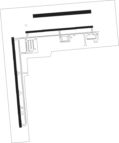
Runway info
Runway 18 / 36  | ||
| length | 1224m (4016ft) | |
| bearing | 179° / 359° | |
| width | 30m (98ft) | |
| surface | asphalt | |
| Runway 10 / 28 | ||
| length | 912m (2992ft) | |
| bearing | 90° / 270° | |
| width | 23m (75ft) | |
| surface | asphalt | |
| Runway 09L / 27R | ||
| length | 763m (2503ft) | |
| bearing | 90° / 270° | |
| width | 46m (150ft) | |
| surface | grass | |
Nearby beacons
| code | identifier | dist | bearing | frequency |
|---|---|---|---|---|
| HST | HOMESTEAD TACAN | 9.4 | 93° | 108.20 |
| DHP | DOLPHIN (MIAMI) VORTAC | 21.2 | 34° | 113.90 |
| VKZ | VIRGINIA KEY VOR/DME | 26.4 | 58° | 117.10 |
| FLL | FORT LAUDERDALE VOR/DME | 40.3 | 34° | 114.40 |
| FX | PRAIZ (FT LAUDERDALE) NDB | 43.4 | 20° | 221 |
| MTH | MARATHON NDB | 55.6 | 214° | 260 |
Departure and arrival routes
| Transition altitude | 18000ft |
| Transition level | 18000ft |
| SID end points | distance | outbound heading | |
|---|---|---|---|
| RW10 | |||
| FOLZZ1 | 267mi | 29° | |
| MELLZ1 | 121mi | 135° | |
| MHITO1 | 140mi | 233° | |
| BNGOS1 | 70mi | 326° | |
| HURCN1 | 176mi | 329° | |
| AARPS1 | 174mi | 350° | |
| VACAY1 | 111mi | 351° | |
| RW18 | |||
| FOLZZ1 | 267mi | 29° | |
| MELLZ1 | 121mi | 135° | |
| MHITO1 | 140mi | 233° | |
| BNGOS1 | 70mi | 326° | |
| HURCN1 | 176mi | 329° | |
| AARPS1 | 174mi | 350° | |
| VACAY1 | 111mi | 351° | |
| RW28 | |||
| FOLZZ1 | 267mi | 29° | |
| MELLZ1 | 121mi | 135° | |
| MHITO1 | 140mi | 233° | |
| BNGOS1 | 70mi | 326° | |
| HURCN1 | 176mi | 329° | |
| AARPS1 | 174mi | 350° | |
| VACAY1 | 111mi | 351° | |
| RW36 | |||
| FOLZZ1 | 267mi | 29° | |
| MELLZ1 | 121mi | 135° | |
| MHITO1 | 140mi | 233° | |
| BNGOS1 | 70mi | 326° | |
| HURCN1 | 176mi | 329° | |
| AARPS1 | 174mi | 350° | |
| VACAY1 | 111mi | 351° | |
| STAR starting points | distance | inbound heading | |
|---|---|---|---|
| ALL | |||
| BLUFI4 | 92.3 | 207° | |
| ANNEY4 | 64.1 | 208° | |
| RW10 | |||
| SNDBR1 | 17.9 | 70° | |
| PALMZ2 | 57.6 | 114° | |
| FROGZ1 | 36.0 | 131° | |
| CSTAL1 | 63.3 | 207° | |
| TARPN1 | 68.5 | 209° | |
| VIICE1 | 45.5 | 278° | |
| FOWEE2 | 81.3 | 292° | |
| RW18 | |||
| SNDBR1 | 17.9 | 70° | |
| PALMZ2 | 57.6 | 114° | |
| FROGZ1 | 36.0 | 131° | |
| CSTAL1 | 63.3 | 207° | |
| TARPN1 | 68.5 | 209° | |
| VIICE1 | 45.5 | 278° | |
| FOWEE2 | 81.3 | 292° | |
| RW28 | |||
| SNDBR1 | 17.9 | 70° | |
| PALMZ2 | 57.6 | 114° | |
| FROGZ1 | 36.0 | 131° | |
| CSTAL1 | 63.3 | 207° | |
| TARPN1 | 68.5 | 209° | |
| VIICE1 | 45.5 | 278° | |
| FOWEE2 | 81.3 | 292° | |
| RW36 | |||
| SNDBR1 | 17.9 | 70° | |
| PALMZ2 | 57.6 | 114° | |
| FROGZ1 | 36.0 | 131° | |
| CSTAL1 | 63.3 | 207° | |
| TARPN1 | 68.5 | 209° | |
| VIICE1 | 45.5 | 278° | |
| FOWEE2 | 81.3 | 292° | |
Instrument approach procedures
| runway | airway (heading) | route (dist, bearing) |
|---|---|---|
| RW10 | DVALL (92°) | DVALL HOLMU (13mi, 93°) 2000ft |
| RW10 | FAMIN (107°) | FAMIN HOLMU (7mi, 134°) 2000ft HOLMU (turn) 2000ft |
| RNAV | HOLMU 2000ft WEMBA (6mi, 90°) 1500ft YIYNU (2mi, 90°) 860ft XAGUH (2mi, 90°) 206ft (4894mi, 108°) 500ft HOLMU (4904mi, 288°) 2000ft HOLMU (turn) | |
| RW28 | LUVLY (249°) | LUVLY CACSA (3mi, 261°) 2000ft RONEY (9mi, 239°) 2000ft |
| RNAV | RONEY 2000ft ZURBU (6mi, 251°) 2000ft JIDBO (2mi, 252°) 1200ft ZENAX (3mi, 252°) 278ft (4892mi, 108°) 500ft HOLMU (4904mi, 288°) 2000ft HOLMU (turn) |
Holding patterns
| STAR name | hold at | type | turn | heading* | altitude | leg | speed limit |
|---|---|---|---|---|---|---|---|
| ANNEY4 | PBI | NDB | right | 90 (270)° | 1.0min timed | ICAO rules | |
| ANNEY4 | PCMAN | VHF | left | 341 (161)° | 1.5min timed | ICAO rules | |
| ANNEY4 | TRV | NDB | left | 347 (167)° | < 17999ft | 1.0min timed | ICAO rules |
| BLUFI4 | LEBUR | VHF | left | 10 (190)° | < 17999ft | DME 8.0mi | ICAO rules |
| CSTAL1 | BEEIN | VHF | right | 347 (167)° | DME 10.0mi | ICAO rules | |
| CSTAL1 | CSTAL | VHF | left | 352 (172)° | DME 10.0mi | ICAO rules | |
| CSTAL1 | XPRSO | VHF | left | 346 (166)° | DME 10.0mi | ICAO rules | |
| CSTAL1 | YEPPA | VHF | left | 346 (166)° | DME 10.0mi | ICAO rules | |
| FOWEE2 | FOWEE | VHF | left | 137 (317)° | DME 7.0mi | ICAO rules | |
| FOWEE2 | JUNUR | VHF | left | 137 (317)° | DME 10.0mi | ICAO rules | |
| FROGZ1 | BETTL | VHF | right | 325 (145)° | DME 10.0mi | ICAO rules | |
| FROGZ1 | DANSE | VHF | right | 344 (164)° | DME 10.0mi | ICAO rules | |
| FROGZ1 | FROGZ | VHF | right | 319 (139)° | DME 10.0mi | ICAO rules | |
| FROGZ1 | GAWKS | VHF | left | 287 (107)° | DME 15.0mi | ICAO rules | |
| FROGZ1 | HARAP | VHF | right | 317 (137)° | DME 10.0mi | ICAO rules | |
| FROGZ1 | MATCY | VHF | right | 317 (137)° | DME 10.0mi | ICAO rules | |
| PALMZ2 | DUMDY | VHF | right | 340 (160)° | DME 4.0mi | ICAO rules | |
| PALMZ2 | PRIVY | VHF | right | 281 (101)° | DME 10.0mi | ICAO rules | |
| SNDBR1 | PAMPR | VHF | left | 240 (60)° | DME 10.0mi | ICAO rules | |
| SNDBR1 | PEAKY | VHF | left | 191 (11)° | DME 10.0mi | ICAO rules | |
| SNDBR1 | SNDBR | VHF | right | 209 (29)° | DME 10.0mi | ICAO rules | |
| VIICE1 | CLYER | VHF | left | 129 (309)° | DME 10.0mi | ICAO rules | |
| VIICE1 | MADIZ | VHF | right | 129 (309)° | DME 10.0mi | ICAO rules | |
| VIICE1 | MULYN | VHF | right | 154 (334)° | DME 10.0mi | ICAO rules | |
| VIICE1 | SUTON | VHF | right | 93 (273)° | DME 10.0mi | ICAO rules | |
| VIICE1 | VIICE | VHF | left | 128 (308)° | DME 10.0mi | ICAO rules | |
| *) magnetic outbound (inbound) holding course | |||||||
Disclaimer
The information on this website is not for real aviation. Use this data with the X-Plane flight simulator only! Data taken with kind consent from X-Plane 12 source code and data files. Content is subject to change without notice.