Vermilion Bay
Airport details
| Country | Canada |
| State | Ontario |
| Region | CY |
| Airspace | Winnipeg Ctr |
| Municipality | Machin Township |
| Elevation | 1284ft (391m) |
| Timezone | GMT -6 |
| Coordinates | 49.87972, -93.43639 |
| Magnetic var | |
| Type | land |
| Available since | X-Plane v10.40 |
| ICAO code | XC003N |
| IATA code | n/a |
| FAA code | n/a |
Communication
| Vermilion Bay ATF | 130.700 |
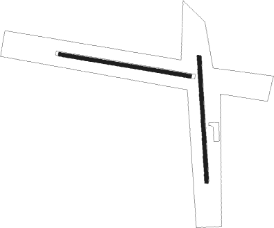
Runway info
Runway 18 / 36  | ||
| length | 808m (2651ft) | |
| bearing | 181° / 1° | |
| width | 23m (75ft) | |
| surface | dirt | |
| Runway 10 / 28 | ||
| length | 854m (2802ft) | |
| bearing | 99° / 279° | |
| width | 23m (75ft) | |
| surface | gravel | |
Nearby beacons
| code | identifier | dist | bearing | frequency |
|---|---|---|---|---|
| YHD | DRYDEN NDB | 22.7 | 91° | 413 |
| VBI | SIOUX NARROWS VOR/DME | 33.8 | 237° | 115.20 |
| YQK | KENORA NDB | 38.6 | 265° | 326 |
Disclaimer
The information on this website is not for real aviation. Use this data with the X-Plane flight simulator only! Data taken with kind consent from X-Plane 12 source code and data files. Content is subject to change without notice.