North Norfolk - Macgregor
Airport details
| Country | Canada |
| State | Manitoba |
| Region | |
| Airspace | Winnipeg Ctr |
| Municipality | Municipality of North Norfolk |
| Elevation | 950ft (290m) |
| Timezone | GMT -6 |
| Coordinates | 49.96742, -98.76041 |
| Magnetic var | |
| Type | land |
| Available since | X-Plane v10.40 |
| ICAO code | XC004H |
| IATA code | n/a |
| FAA code | n/a |
Communication
Nearby Points of Interest:
MacGregor Canadian Pacific Railway Water Tower
-Fort La Reine
-Portage la Prairie Canadian Pacific Railway Station
-Portage la Prairie railway station
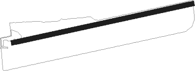
Runway info
| Runway 08 / 26 | ||
| length | 774m (2539ft) | |
| bearing | 85° / 265° | |
| width | 20m (65ft) | |
| surface | dirt | |
Nearby beacons
| code | identifier | dist | bearing | frequency |
|---|---|---|---|---|
| YPG | PORTAGE (PORTAGE LA PRAIR VOR/DME | 19.4 | 98° | 114.60 |
| UDE | DELTA NDB | 21.1 | 66° | 269 |
| PG | PORTAGE (PORTAGE LA PRAIRIE) NDB | 23.6 | 102° | 353 |
| VLR | LANGRUTH VOR/DME | 27.3 | 5° | 112.20 |
Disclaimer
The information on this website is not for real aviation. Use this data with the X-Plane flight simulator only! Data taken with kind consent from X-Plane 12 source code and data files. Content is subject to change without notice.