Deerbrook - Stoney Point Trepanier
Airport details
| Country | Canada |
| State | Ontario |
| Region | CY |
| Airspace | Cleveland Ctr |
| Municipality | Lakeshore |
| Elevation | 628ft (191m) |
| Timezone | GMT -5 |
| Coordinates | 42.28889, -82.59834 |
| Magnetic var | |
| Type | land |
| Available since | X-Plane v10.40 |
| ICAO code | XC0057 |
| IATA code | n/a |
| FAA code | n/a |
Communication
Nearby Points of Interest:
Comber railway station
-Grosse Pointe War Memorial
-Paul Harvey Deming House
-Grosse Pointe Academy
-Dodge Mansion
-Carl E. and Alice Candler Schmidt House
-Grosse Pointe Memorial Church
-John T. Woodhouse House
-Grosse Pointe Yacht Club
-Charles J. and Ingrid V. (Frendberg) Koebel House
-Père Gabriel Richard Elementary School
-William and Margot Kessler House
-William B. and Mary Chase Stratton House
-St. Clair Flats Range Front Light
-St. Clair Flats Rear Range Light
-Jefferson-Chalmers Historic Business District
-Vanity Ballroom Building
-Alger Theater
-Detroit Yacht Club
-Pilgrim and Puritan Apartment Complex
-Hibbard Apartment Building
-Arthur M. Parker House
-Alden Park Towers
-Frederick K. Stearns House
-River Terrace Apartments
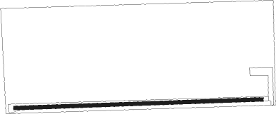
Runway info
| Runway 09 / 27 | ||
| length | 654m (2146ft) | |
| bearing | 92° / 272° | |
| width | 9m (30ft) | |
| surface | grass | |
| displ threshold | 0m (0ft) / 122m (400ft) | |
Nearby beacons
| code | identifier | dist | bearing | frequency |
|---|---|---|---|---|
| QG | WINDSOR NDB | 12 | 275° | 353 |
| MTC | SELFRIDGE (MOUNT CLEMENS) TACAN | 22 | 324° | 133.70 |
| RYS | GROSSE ILE (DETROIT) NDB | 27.1 | 251° | 419 |
| DM | SPENC (DETROIT) NDB | 27.2 | 264° | 223 |
| PH | PHURN (PORT HURON) NDB | 33.2 | 0° | 332 |
| DXO | DETROIT VOR/DME | 34.4 | 264° | 113.40 |
| DT | REVUP (DETROIT) NDB | 38.4 | 259° | 388 |
| CRL | CARLETON VOR/DME | 40.8 | 254° | 115.70 |
| SVM | SALEM VORTAC | 44.7 | 277° | 114.30 |
| PCW | PORT CLINTON NDB | 47.8 | 199° | 423 |
| PSI | DME | 48.2 | 294° | 111 |
| ECK | PECK TACAN | 58.3 | 353° | 114 |
| DJB | DRYER VOR/DME | 59.2 | 155° | 113.60 |
Disclaimer
The information on this website is not for real aviation. Use this data with the X-Plane flight simulator only! Data taken with kind consent from X-Plane 12 source code and data files. Content is subject to change without notice.