Amherstburg - Amherstburg Pvt
Airport details
| Country | Canada |
| State | Ontario |
| Region | |
| Airspace | Cleveland Ctr |
| Municipality | Amherstburg |
| Elevation | 589ft (180m) |
| Timezone | GMT -5 |
| Coordinates | 42.15250, -83.06795 |
| Magnetic var | |
| Type | land |
| Available since | X-Plane v11.50 |
| ICAO code | XC007O |
| IATA code | n/a |
| FAA code | n/a |
Communication
Nearby Points of Interest:
Amherstburg MCR Station
-Amherstburg First Baptist Church
-Parke Lane Road–Thorofare Canal Bridge
-East River Road Historic District
-St. James Episcopal Church
-Ford-Bacon House
-Marx House
-George P. MacNichol House
-John and Emma Lacey Eberts House
-Gibraltar Road–Waterway Canal Bridge
-Ste. Claire
-Mellus Newspapers Building
-Lincoln Park Post Office
-West Jefferson Avenue–Rouge River Bridge
-Fort Street–Pleasant Street and Norfolk & Western Railroad Viaduct
-Hull's Trace North Huron River Corduroy Segment
-Dominion House
-Jefferson Avenue–Huron River and Harbin Drive–Silver Creek Canal Bridges
-James A. Garfield School
-West Vernor-Lawndale Historic District
-West Vernor-Junction Historic District
-Ford River Rouge Complex
-United States Postal Service Roosevelt Park Station
-Michigan Central Station
-Detroit News Complex
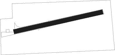
Runway info
| Runway 08 / 26 | ||
| length | 420m (1378ft) | |
| bearing | 84° / 264° | |
| width | 21m (70ft) | |
| surface | grass | |
Nearby beacons
| code | identifier | dist | bearing | frequency |
|---|---|---|---|---|
| RYS | GROSSE ILE (DETROIT) NDB | 4.8 | 239° | 419 |
| DM | SPENC (DETROIT) NDB | 7.2 | 297° | 223 |
| QG | WINDSOR NDB | 13 | 51° | 353 |
| DXO | DETROIT VOR/DME | 13.7 | 281° | 113.40 |
| DT | REVUP (DETROIT) NDB | 16.3 | 265° | 388 |
| CRL | CARLETON VOR/DME | 18.4 | 255° | 115.70 |
| SVM | SALEM VORTAC | 27.9 | 296° | 114.30 |
| MTC | SELFRIDGE (MOUNT CLEMENS) TACAN | 29.5 | 27° | 133.70 |
| TCU | TECUMSEH NDB | 37.1 | 262° | 239 |
| PSI | DME | 38.8 | 320° | 111 |
| PCW | PORT CLINTON NDB | 39 | 163° | 423 |
| PH | PHURN (PORT HURON) NDB | 46.4 | 34° | 332 |
| TOL | TOLEDO TACAN | 46.8 | 233° | 112.50 |
| TO | TOPHR (TOLEDO) NDB | 52.4 | 235° | 219 |
| FNT | FLINT VORTAC | 57.3 | 320° | 116.90 |
| DJB | DRYER VOR/DME | 62.6 | 131° | 113.60 |
Disclaimer
The information on this website is not for real aviation. Use this data with the X-Plane flight simulator only! Data taken with kind consent from X-Plane 12 source code and data files. Content is subject to change without notice.